El Yucateco geodata
El Yucateco (Tabasco) is a populated place; located in Mexico in America/Mexico_City (GMT-6) time zone. With population of 947 people, there are 9196 cities with bigger population in this country. Compared to other cities in Mexico, 76% of cities are located further ↑North; 85.8% of cities are located further ←West and 95.7% of cities have higher elevation than El Yucateco. Note1


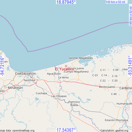
El Yucateco GPS coordinates[2]
18° 12' 46.224" North, 94° 1' 4.908" West
| Map corner | latitude | longitude |
|---|---|---|
| Upper-left | 18.87945°, | -94.72116° |
| Center: | 18.21284°, | -94.01803° |
| Lower-right: | 17.54367°, | -93.31491° |
| Map W x H: | 148.5×148.5 km | = 92.3×92.3mi |
| max Lat: | 32.7° ⇑76% North |
| El Yucateco: | 18.21284° |
| min Lat: | ⇓24% South 14.53588° |
| min Long | El Yucateco | max Long |
| -117.105° | -94.01803° | -86.73105° |
| W 85.8%⇐ | ⇒14.2% E |
Elevation
Elevation of El Yucateco is 12 m = 39 ft, and this is 1241.7 m = 4074 ft below average elevation for this country.
| Max E: |
3497 m = 11473 ft | 95.7% |
| Avg. | 1253.7 m = 4113 ft | |
| El Yucateco | 12 m = 39 ft | |
Min E: |
-1 m = -3 ft | 4.3% |
See also: Mexico elevation on elevation.city.
Geographical zone
El Yucateco is located in North Torrid zone (between Equator and Tropic of Cancer). Distance of this Northern Tropic circle is 580.8 km =360.9 mi to North.| Distance of | km | miles | from El Yucateco |
|---|---|---|---|
| North Pole | 7982 | 4959.8 | to North |
| Arctic Circle | 5376.1 | 3340.6 | to North |
| Tropic Cancer | 580.8 | 360.9 | to North |
| Equator | 2025.1 | 1258.3 | to South |


Nearby cities:
15 places around El Yucateco: (largest is in red/bold)
• Agua Dulce
15.7 km =9.8 mi,  238°
238°
• Benito Juárez 1ra. Sección
20.7 km =12.9 mi,  134°
134°
• Blasillo 1ra. Sección (Nicolás Bravo)
18.3 km =11.4 mi,  144°
144°
• Blasillo 2da. Sección (Otates)
18.3 km =11.4 mi,  154°
154°
• Cuauhtemoczin
11.5 km =7.1 mi,  264°
264°
• El Barí 1ra. Sección
6.7 km =4.2 mi,  268°
268°
• El Encanto
26.7 km =16.6 mi,  204°
204°
• El Porvenir
28.6 km =17.8 mi,  112°
112°
• Guillermo Prieto
27.9 km =17.3 mi, 258°
• La Vencedora
26.1 km =16.2 mi, 133°
• Los Manantiales
19 km =11.8 mi,  210°
210°
• Pejelagartero 1ra. Sección (El Arroyito)
32.2 km =20 mi, 129°
• Pejelagartero 1ra. Sección (Plataforma)
26.9 km =16.7 mi, 130°
• Tonalá
13.1 km =8.1 mi, 267°
• Villa la Venta
13 km =8.1 mi,  193°
193°
Sources, notices
• [Note1] Compared only with cities in Mexico existing in our database
• [Src1] Map data: © OpenStreetMap contributors (CC-BY-SA)
• [Src2] Other city data from geonames.org with taken over terms of usage.
• [Src3] Geographical zone / Annual Mean Temperature by Robert A. Rohde @ Wikipedia
