Yabteclum (Pueblo Viejo) geodata
Yabteclum (Pueblo Viejo) (Chiapas) is a populated place; located in Mexico in America/Mexico_City (GMT-6) time zone. With population of 572 people, there are 14957 cities with bigger population in this country. Compared to other cities in Mexico, 89.7% of cities are located further ↑North; 91.3% of cities are located further ←West and 55.2% of cities have lower elevation than Yabteclum (Pueblo Viejo). Note1
Current local time in Yabteclum (Pueblo Viejo):
07:25 AM, MondayDifference from your time zone: hours


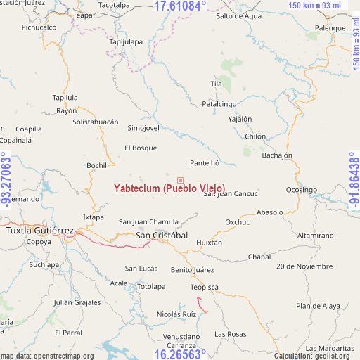
Yabteclum (Pueblo Viejo) GPS coordinates[2]
16° 56' 21.984" North, 92° 34' 3" West
| Map corner | latitude | longitude |
|---|---|---|
| Upper-left | 17.61084°, | -93.27063° |
| Center: | 16.93944°, | -92.5675° |
| Lower-right: | 16.26563°, | -91.86438° |
| Map W x H: | 149.6×149.6 km | = 93×93mi |
| max Lat: | 32.7° ⇑89.7% North |
| Yabteclum (Pueblo Viejo): | 16.93944° |
| min Lat: | ⇓10.3% South 14.53588° |
| min Long | Yabteclum (Pueb | max Long |
| -117.105° | -92.5675° | -86.73105° |
| W 91.3%⇐ | ⇒8.7% E |
Elevation
Elevation of Yabteclum (Pueblo Viejo) is 1593 m = 5226 ft, and this is 339.3 m = 1113 ft above average elevation for this country.
| Max E: |
3497 m = 11473 ft | 44.8% |
| Yabteclum (Pueblo Viejo) | 1593 m 5226 ft | |
| Avg. | 1253.7 m = 4113 ft | |
Min E: |
-1 m = -3 ft | 55.2% |
See also: Mexico elevation on elevation.city.
Geographical zone
Yabteclum (Pueblo Viejo) is located in North Torrid zone (between Equator and Tropic of Cancer). Distance of this Northern Tropic circle is 722.4 km =448.9 mi to North.| Distance of | km | miles | from Yabteclum (Pueblo Viejo) |
|---|---|---|---|
| North Pole | 8123.6 | 5047.8 | to North |
| Arctic Circle | 5517.7 | 3428.5 | to North |
| Tropic Cancer | 722.4 | 448.9 | to North |
| Equator | 1883.5 | 1170.4 | to South |


Nearby cities:
15 places around Yabteclum (Pueblo Viejo): (largest is in red/bold)
• Alamul
7.4 km =4.6 mi,  143°
143°
• Bashequen
7.6 km =4.7 mi,  216°
216°
• Chalam
6 km =3.7 mi,  162°
162°
• Chalchihuitán
6.1 km =3.8 mi,  296°
296°
• Chimhucum
6.7 km =4.2 mi,  145°
145°
• La Libertad
3.9 km =2.4 mi,  178°
178°
• Puebla
7.3 km =4.5 mi,  111°
111°
• Pulumsibac
7.3 km =4.5 mi, 151°
• Suyalhó
6.7 km =4.2 mi,  188°
188°
• Titaltetic
7.5 km =4.7 mi,  170°
170°
• Tojtic
5.9 km =3.7 mi, 165°
• Tzoeptic
6.3 km =3.9 mi, 180°
• Yabteclum Fracción Dos
1.2 km =0.7 mi, 145°
• Yaxalumil
2.5 km =1.6 mi,  203°
203°
• Yibeljoj
7.1 km =4.4 mi,  73°
73°
Sources, notices
• [Note1] Compared only with cities in Mexico existing in our database
• [Src1] Map data: © OpenStreetMap contributors (CC-BY-SA)
• [Src2] Other city data from geonames.org with taken over terms of usage.
• [Src3] Geographical zone / Annual Mean Temperature by Robert A. Rohde @ Wikipedia
