Lima Vieja geodata
Lima Vieja (Veracruz) is a populated place; located in Mexico in America/Mexico_City (GMT-6) time zone. With population of 560 people, there are 15231 cities with bigger population in this country. Compared to other cities in Mexico, 73.1% of cities are located further ↓South; 68.1% of cities are located further ←West and 83% of cities have higher elevation than Lima Vieja. Note1


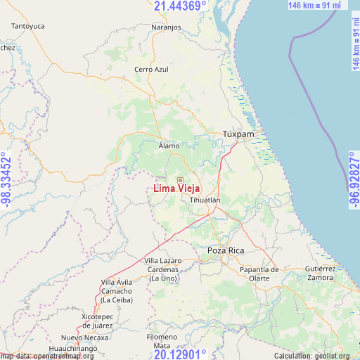
Lima Vieja GPS coordinates[2]
20° 47' 16.008" North, 97° 37' 53.004" West
| Map corner | latitude | longitude |
|---|---|---|
| Upper-left | 21.44369°, | -98.33452° |
| Center: | 20.78778°, | -97.63139° |
| Lower-right: | 20.12901°, | -96.92827° |
| Map W x H: | 146.2×146.2 km | = 90.8×90.8mi |
| max Lat: | 32.7° ⇑26.9% North |
| Lima Vieja: | 20.78778° |
| min Lat: | ⇓73.1% South 14.53588° |
| min Long | Lima Vieja | max Long |
| -117.105° | -97.63139° | -86.73105° |
| W 68.1%⇐ | ⇒31.9% E |
Elevation
Elevation of Lima Vieja is 60 m = 197 ft, and this is 1193.7 m = 3916 ft below average elevation for this country.
| Max E: |
3497 m = 11473 ft | 83% |
| Avg. | 1253.7 m = 4113 ft | |
| Lima Vieja | 60 m = 197 ft | |
Min E: |
-1 m = -3 ft | 17% |
See also: Mexico elevation on elevation.city.
Geographical zone
Lima Vieja is located in North Torrid zone (between Equator and Tropic of Cancer). Distance of this Northern Tropic circle is 294.5 km =183 mi to North.| Distance of | km | miles | from Lima Vieja |
|---|---|---|---|
| North Pole | 7695.7 | 4781.9 | to North |
| Arctic Circle | 5089.8 | 3162.7 | to North |
| Tropic Cancer | 294.5 | 183 | to North |
| Equator | 2311.4 | 1436.2 | to South |


Nearby cities:
15 places around Lima Vieja: (largest is in red/bold)
• Aquiles Serdán
8.2 km =5.1 mi,  315°
315°
• Buenos Aires (San Isidro)
6.6 km =4.1 mi,  28°
28°
• Castillo de Teayo
4.3 km =2.7 mi,  178°
178°
• Cerro Dulce
6.6 km =4.1 mi,  16°
16°
• Citlaltépetl
8.8 km =5.5 mi, 16°
• El Bejucal
3.4 km =2.1 mi,  303°
303°
• El Terrero
9.1 km =5.7 mi,  81°
81°
• Francisco Villa
7.3 km =4.5 mi,  86°
86°
• La Granadilla
8.3 km =5.2 mi,  51°
51°
• La Providencia
8.8 km =5.5 mi,  313°
313°
• La Reforma
9 km =5.6 mi,  343°
343°
• Mequetla
6 km =3.7 mi,  277°
277°
• Teayo
7 km =4.3 mi,  225°
225°
• Tecomate
8.2 km =5.1 mi,  99°
99°
• Tincontlán
7.2 km =4.5 mi, 301°
Sources, notices
• [Note1] Compared only with cities in Mexico existing in our database
• [Src1] Map data: © OpenStreetMap contributors (CC-BY-SA)
• [Src2] Other city data from geonames.org with taken over terms of usage.
• [Src3] Geographical zone / Annual Mean Temperature by Robert A. Rohde @ Wikipedia
