Paso Nuevo geodata
Paso Nuevo (Veracruz) is a populated place; located in Mexico in America/Mexico_City (GMT-6) time zone. With population of 555 people, there are 15371 cities with bigger population in this country. Compared to other cities in Mexico, 71.4% of cities are located further ↑North; 79.3% of cities are located further ←West and 76.6% of cities have higher elevation than Paso Nuevo. Note1


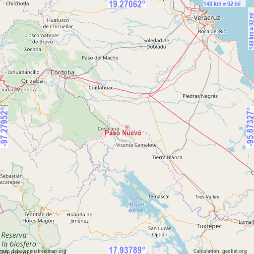
Paso Nuevo GPS coordinates[2]
18° 36' 20.016" North, 96° 34' 35.004" West
| Map corner | latitude | longitude |
|---|---|---|
| Upper-left | 19.27062°, | -97.27952° |
| Center: | 18.60556°, | -96.57639° |
| Lower-right: | 17.93789°, | -95.87327° |
| Map W x H: | 148.2×148.2 km | = 92.1×92.1mi |
| max Lat: | 32.7° ⇑71.4% North |
| Paso Nuevo: | 18.60556° |
| min Lat: | ⇓28.6% South 14.53588° |
| min Long | Paso Nuevo | max Long |
| -117.105° | -96.57639° | -86.73105° |
| W 79.3%⇐ | ⇒20.7% E |
Elevation
Elevation of Paso Nuevo is 165 m = 541 ft, and this is 1088.7 m = 3572 ft below average elevation for this country.
| Max E: |
3497 m = 11473 ft | 76.6% |
| Avg. | 1253.7 m = 4113 ft | |
| Paso Nuevo | 165 m = 541 ft | |
Min E: |
-1 m = -3 ft | 23.4% |
See also: Mexico elevation on elevation.city.
Geographical zone
Paso Nuevo is located in North Torrid zone (between Equator and Tropic of Cancer). Distance of this Northern Tropic circle is 537.2 km =333.8 mi to North.| Distance of | km | miles | from Paso Nuevo |
|---|---|---|---|
| North Pole | 7938.3 | 4932.6 | to North |
| Arctic Circle | 5332.4 | 3313.4 | to North |
| Tropic Cancer | 537.2 | 333.8 | to North |
| Equator | 2068.7 | 1285.4 | to South |


Nearby cities:
15 places around Paso Nuevo: (largest is in red/bold)
• Acatlán de Pérez Figueroa
7.9 km =4.9 mi,  202°
202°
• Almolonga
8.9 km =5.5 mi,  272°
272°
• Barbasco
2.9 km =1.8 mi,  144°
144°
• Cañamazal
9.7 km =6 mi,  117°
117°
• Colonia Primero de Mayo
7.7 km =4.8 mi,  329°
329°
• Cosolapa
11.5 km =7.1 mi, 267°
• Huixcolotla
10.7 km =6.6 mi,  51°
51°
• La Defensa
12.1 km =7.5 mi,  162°
162°
• Loma del Izote (Mata Planta)
3.5 km =2.2 mi,  305°
305°
• Palma Sola
5.4 km =3.4 mi,  286°
286°
• Paso Amapa
9.3 km =5.8 mi,  302°
302°
• Río Moreno
10.9 km =6.8 mi,  316°
316°
• Tezonapa
11.4 km =7.1 mi, 270°
• Vicente Camalote
11.3 km =7 mi,  153°
153°
• Zona Urbana Ejidal
8.2 km =5.1 mi,  189°
189°
Sources, notices
• [Note1] Compared only with cities in Mexico existing in our database
• [Src1] Map data: © OpenStreetMap contributors (CC-BY-SA)
• [Src2] Other city data from geonames.org with taken over terms of usage.
• [Src3] Geographical zone / Annual Mean Temperature by Robert A. Rohde @ Wikipedia
