Los Hornos geodata
Los Hornos (State of Mexico) is a populated place; located in Mexico in America/Mexico_City (GMT-6) time zone. With population of 547 people, there are 15556 cities with bigger population in this country. Compared to other cities in Mexico, 57.4% of cities are located further ↑North; 52.6% of cities are located further ←West and 86.8% of cities have lower elevation than Los Hornos. Note1


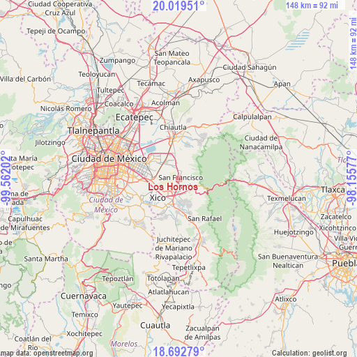
Los Hornos GPS coordinates[2]
19° 21' 27" North, 98° 51' 32.004" West
| Map corner | latitude | longitude |
|---|---|---|
| Upper-left | 20.01951°, | -99.56202° |
| Center: | 19.3575°, | -98.85889° |
| Lower-right: | 18.69279°, | -98.15577° |
| Map W x H: | 147.5×147.5 km | = 91.7×91.7mi |
| max Lat: | 32.7° ⇑57.4% North |
| Los Hornos: | 19.3575° |
| min Lat: | ⇓42.6% South 14.53588° |
| min Long | Los Hornos | max Long |
| -117.105° | -98.85889° | -86.73105° |
| W 52.6%⇐ | ⇒47.4% E |
Elevation
Elevation of Los Hornos is 2303 m = 7556 ft, and this is 1049.3 m = 3443 ft above average elevation for this country.
| Max E: |
3497 m = 11473 ft | 13.2% |
| Los Hornos | 2303 m 7556 ft | |
| Avg. | 1253.7 m = 4113 ft | |
Min E: |
-1 m = -3 ft | 86.8% |
See also: Mexico elevation on elevation.city.
Geographical zone
Los Hornos is located in North Torrid zone (between Equator and Tropic of Cancer). Distance of this Northern Tropic circle is 453.6 km =281.9 mi to North.| Distance of | km | miles | from Los Hornos |
|---|---|---|---|
| North Pole | 7854.7 | 4880.7 | to North |
| Arctic Circle | 5248.8 | 3261.5 | to North |
| Tropic Cancer | 453.6 | 281.9 | to North |
| Equator | 2152.4 | 1337.4 | to South |


Nearby cities:
15 places around Los Hornos: (largest is in red/bold)
• Ampliación 6 de Junio
7.4 km =4.6 mi,  252°
252°
• Chicoloapan
8 km =5 mi,  325°
325°
• Coatepec
3.4 km =2.1 mi,  24°
24°
• Ejido la Venta Cuautlalpan
7.1 km =4.4 mi,  346°
346°
• Ixtapaluca
5.3 km =3.3 mi,  208°
208°
• Jorge Jiménez Cantú
5.5 km =3.4 mi,  166°
166°
• Lomas de San Sebastián
8.3 km =5.2 mi,  289°
289°
• San Buenaventura
6.1 km =3.8 mi,  184°
184°
• San Francisco Acuautla
1.3 km =0.8 mi,  186°
186°
• San Jerónimo Cuatro Vientos
7.4 km =4.6 mi, 165°
• San José las Palmas
7.9 km =4.9 mi,  277°
277°
• San Marcos Huixtoco
6.8 km =4.2 mi, 184°
• Techachaltitla
8.6 km =5.3 mi, 275°
• Unidad Acaquilpan
8.5 km =5.3 mi, 277°
• Zoquiapan
4.5 km =2.8 mi, 167°
Sources, notices
• [Note1] Compared only with cities in Mexico existing in our database
• [Src1] Map data: © OpenStreetMap contributors (CC-BY-SA)
• [Src2] Other city data from geonames.org with taken over terms of usage.
• [Src3] Geographical zone / Annual Mean Temperature by Robert A. Rohde @ Wikipedia
