Coatepec geodata
Coatepec (State of Mexico) is a populated place; located in Mexico in America/Mexico_City (GMT-6) time zone. With population of 8,841 people, there are 1071 cities with bigger population in this country. Compared to other cities in Mexico, 56.7% of cities are located further ↑North; 52.9% of cities are located further ←West and 90.4% of cities have lower elevation than Coatepec. Note1


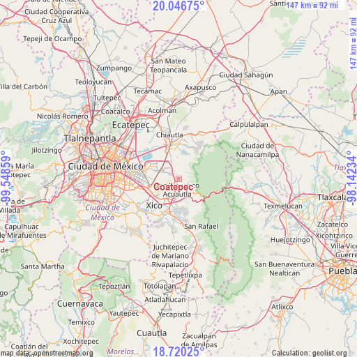
Coatepec GPS coordinates[2]
19° 23' 5.46" North, 98° 50' 43.656" West
| Map corner | latitude | longitude |
|---|---|---|
| Upper-left | 20.04675°, | -99.54859° |
| Center: | 19.38485°, | -98.84546° |
| Lower-right: | 18.72025°, | -98.14234° |
| Map W x H: | 147.5×147.5 km | = 91.7×91.7mi |
| max Lat: | 32.7° ⇑56.7% North |
| Coatepec: | 19.38485° |
| min Lat: | ⇓43.3% South 14.53588° |
| min Long | Coatepec | max Long |
| -117.105° | -98.84546° | -86.73105° |
| W 52.9%⇐ | ⇒47.1% E |
Elevation
Elevation of Coatepec is 2420 m = 7940 ft, and this is 1166.3 m = 3826 ft above average elevation for this country.
| Max E: |
3497 m = 11473 ft | 9.6% |
| Coatepec | 2420 m 7940 ft | |
| Avg. | 1253.7 m = 4113 ft | |
Min E: |
-1 m = -3 ft | 90.4% |
See also: Mexico elevation on elevation.city.
Geographical zone
Coatepec is located in North Torrid zone (between Equator and Tropic of Cancer). Distance of this Northern Tropic circle is 450.5 km =279.9 mi to North.| Distance of | km | miles | from Coatepec |
|---|---|---|---|
| North Pole | 7851.7 | 4878.8 | to North |
| Arctic Circle | 5245.8 | 3259.6 | to North |
| Tropic Cancer | 450.5 | 279.9 | to North |
| Equator | 2155.4 | 1339.3 | to South |


Nearby cities:
15 places around Coatepec: (largest is in red/bold)
• Chicoloapan
6.9 km =4.3 mi,  300°
300°
• Colonia Lázaro Cárdenas
9.2 km =5.7 mi,  317°
317°
• Colonia las Tijeras
9 km =5.6 mi,  343°
343°
• Ejido la Venta Cuautlalpan
4.9 km =3 mi, 321°
• Ixtapaluca
8.6 km =5.3 mi,  206°
206°
• Jorge Jiménez Cantú
8.4 km =5.2 mi,  180°
180°
• Lomas de San Sebastián
9.2 km =5.7 mi,  268°
268°
• Los Hornos
3.4 km =2.1 mi,  204°
204°
• Rancho la Cabaña
7.1 km =4.4 mi,  310°
310°
• San Buenaventura
9.3 km =5.8 mi,  191°
191°
• San Francisco Acuautla
4.6 km =2.9 mi, 199°
• San Miguel Coatlinchán
7.8 km =4.8 mi, 338°
• Santa Martha
9.2 km =5.7 mi, 304°
• Santiago Cuautlalpan
7.9 km =4.9 mi, 311°
• Zoquiapan
7.5 km =4.7 mi, 183°
Sources, notices
• [Note1] Compared only with cities in Mexico existing in our database
• [Src1] Map data: © OpenStreetMap contributors (CC-BY-SA)
• [Src2] Other city data from geonames.org with taken over terms of usage.
• [Src3] Geographical zone / Annual Mean Temperature by Robert A. Rohde @ Wikipedia
