Guadalupe Victoria geodata
Guadalupe Victoria (Puebla) is a populated place; located in Mexico in America/Mexico_City (GMT-6) time zone. With population of 536 people, there are 15820 cities with bigger population in this country. Compared to other cities in Mexico, 51% of cities are located further ↑North; 69.2% of cities are located further ←West and 94% of cities have lower elevation than Guadalupe Victoria. Note1


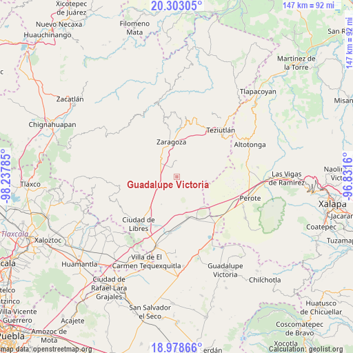
Guadalupe Victoria GPS coordinates[2]
19° 38' 31.992" North, 97° 32' 4.992" West
| Map corner | latitude | longitude |
|---|---|---|
| Upper-left | 20.30305°, | -98.23785° |
| Center: | 19.64222°, | -97.53472° |
| Lower-right: | 18.97866°, | -96.8316° |
| Map W x H: | 147.3×147.3 km | = 91.5×91.5mi |
| max Lat: | 32.7° ⇑51% North |
| Guadalupe Victoria: | 19.64222° |
| min Lat: | ⇓49% South 14.53588° |
| min Long | Guadalupe Victo | max Long |
| -117.105° | -97.53472° | -86.73105° |
| W 69.2%⇐ | ⇒30.8% E |
Elevation
Elevation of Guadalupe Victoria is 2574 m = 8445 ft, and this is 1320.3 m = 4332 ft above average elevation for this country.
| Max E: |
3497 m = 11473 ft | 6% |
| Guadalupe Victoria | 2574 m 8445 ft | |
| Avg. | 1253.7 m = 4113 ft | |
Min E: |
-1 m = -3 ft | 94% |
See also: Mexico elevation on elevation.city.
Geographical zone
Guadalupe Victoria is located in North Torrid zone (between Equator and Tropic of Cancer). Distance of this Northern Tropic circle is 421.9 km =262.2 mi to North.| Distance of | km | miles | from Guadalupe Victoria |
|---|---|---|---|
| North Pole | 7823.1 | 4861 | to North |
| Arctic Circle | 5217.2 | 3241.8 | to North |
| Tropic Cancer | 421.9 | 262.2 | to North |
| Equator | 2184 | 1357.1 | to South |


Nearby cities:
15 places around Guadalupe Victoria: (largest is in red/bold)
• Acuaco
13.7 km =8.5 mi,  346°
346°
• Allende
13.2 km =8.2 mi,  209°
209°
• Cuautlamingo
13.5 km =8.4 mi,  358°
358°
• Cuyoaco
10 km =6.2 mi,  243°
243°
• Francisco I. Madero
5.4 km =3.4 mi,  129°
129°
• Huitzitzilapan
8.3 km =5.2 mi,  324°
324°
• Ixmatlaco
8.3 km =5.2 mi, 349°
• Las Trancas
10.7 km =6.6 mi,  336°
336°
• Morelos
13.3 km =8.3 mi, 340°
• Oyameles de Hidalgo
6.1 km =3.8 mi,  0°
0°
• San Francisco del Progreso
12.4 km =7.7 mi, 321°
• San Miguel Tenextatiloyan
10 km =6.2 mi, 318°
• Temextla
14.3 km =8.9 mi,  255°
255°
• Texcal
5.9 km =3.7 mi,  178°
178°
• Xaltipanapa
9.2 km =5.7 mi,  155°
155°
Sources, notices
• [Note1] Compared only with cities in Mexico existing in our database
• [Src1] Map data: © OpenStreetMap contributors (CC-BY-SA)
• [Src2] Other city data from geonames.org with taken over terms of usage.
• [Src3] Geographical zone / Annual Mean Temperature by Robert A. Rohde @ Wikipedia
