San Caralampio geodata
San Caralampio (Chiapas) is a populated place; located in Mexico in America/Mexico_City (GMT-6) time zone. With population of 533 people, there are 15888 cities with bigger population in this country. Compared to other cities in Mexico, 93.9% of cities are located further ↑North; 95.4% of cities are located further ←West and 58% of cities have lower elevation than San Caralampio. Note1


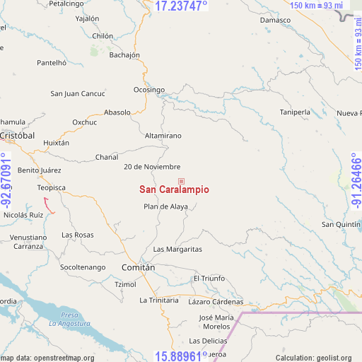
San Caralampio GPS coordinates[2]
16° 33' 52.992" North, 91° 58' 4.008" West
| Map corner | latitude | longitude |
|---|---|---|
| Upper-left | 17.23747°, | -92.67091° |
| Center: | 16.56472°, | -91.96778° |
| Lower-right: | 15.88961°, | -91.26466° |
| Map W x H: | 149.9×149.9 km | = 93.1×93.1mi |
| max Lat: | 32.7° ⇑93.9% North |
| San Caralampio: | 16.56472° |
| min Lat: | ⇓6.1% South 14.53588° |
| min Long | San Caralampio | max Long |
| -117.105° | -91.96778° | -86.73105° |
| W 95.4%⇐ | ⇒4.6% E |
Elevation
Elevation of San Caralampio is 1690 m = 5545 ft, and this is 436.3 m = 1431 ft above average elevation for this country.
| Max E: |
3497 m = 11473 ft | 42% |
| San Caralampio | 1690 m 5545 ft | |
| Avg. | 1253.7 m = 4113 ft | |
Min E: |
-1 m = -3 ft | 58% |
See also: Mexico elevation on elevation.city.
Geographical zone
San Caralampio is located in North Torrid zone (between Equator and Tropic of Cancer). Distance of this Northern Tropic circle is 764.1 km =474.8 mi to North.| Distance of | km | miles | from San Caralampio |
|---|---|---|---|
| North Pole | 8165.2 | 5073.6 | to North |
| Arctic Circle | 5559.3 | 3454.4 | to North |
| Tropic Cancer | 764.1 | 474.8 | to North |
| Equator | 1841.8 | 1144.4 | to South |


Nearby cities:
15 places around San Caralampio: (largest is in red/bold)
• Bajucu
14.3 km =8.9 mi,  226°
226°
• Carmen Rusia
13.9 km =8.6 mi,  84°
84°
• El Vergel
12.2 km =7.6 mi,  277°
277°
• González de León
11.5 km =7.1 mi,  235°
235°
• Jalisco
15 km =9.3 mi,  182°
182°
• Justo Sierra
9.9 km =6.2 mi,  255°
255°
• La Ilusión
11.4 km =7.1 mi,  289°
289°
• La Laguna
14.5 km =9 mi,  7°
7°
• Mexiquito
10.7 km =6.6 mi, 179°
• Nuevo México
12.5 km =7.8 mi,  272°
272°
• Nuevo San Carlos
14.3 km =8.9 mi,  0°
0°
• Plan de Ayala
12.2 km =7.6 mi,  211°
211°
• Rafael Ramírez
11.7 km =7.3 mi,  168°
168°
• Santa Rita Sonora
7.4 km =4.6 mi, 226°
• Veinte de Noviembre
13.6 km =8.5 mi,  296°
296°
Sources, notices
• [Note1] Compared only with cities in Mexico existing in our database
• [Src1] Map data: © OpenStreetMap contributors (CC-BY-SA)
• [Src2] Other city data from geonames.org with taken over terms of usage.
• [Src3] Geographical zone / Annual Mean Temperature by Robert A. Rohde @ Wikipedia
