San Pedro Calantla geodata
San Pedro Calantla (Puebla) is a populated place; located in Mexico in America/Mexico_City (GMT-6) time zone. With population of 531 people, there are 15939 cities with bigger population in this country. Compared to other cities in Mexico, 71.5% of cities are located further ↑North; 58.7% of cities are located further ←West and 52.6% of cities have higher elevation than San Pedro Calantla. Note1


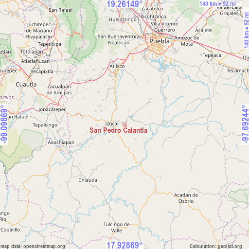
San Pedro Calantla GPS coordinates[2]
18° 35' 47.004" North, 98° 23' 44.016" West
| Map corner | latitude | longitude |
|---|---|---|
| Upper-left | 19.26149°, | -99.09869° |
| Center: | 18.59639°, | -98.39556° |
| Lower-right: | 17.92869°, | -97.69244° |
| Map W x H: | 148.2×148.2 km | = 92.1×92.1mi |
| max Lat: | 32.7° ⇑71.5% North |
| San Pedro Calantla: | 18.59639° |
| min Lat: | ⇓28.5% South 14.53588° |
| min Long | San Pedro Calan | max Long |
| -117.105° | -98.39556° | -86.73105° |
| W 58.7%⇐ | ⇒41.3% E |
Elevation
Elevation of San Pedro Calantla is 1312 m = 4304 ft, and this is 58.3 m = 191 ft above average elevation for this country.
| Max E: |
3497 m = 11473 ft | 52.6% |
| San Pedro Calantla | 1312 m 4304 ft | |
| Avg. | 1253.7 m = 4113 ft | |
Min E: |
-1 m = -3 ft | 47.4% |
See also: Mexico elevation on elevation.city.
Geographical zone
San Pedro Calantla is located in North Torrid zone (between Equator and Tropic of Cancer). Distance of this Northern Tropic circle is 538.2 km =334.4 mi to North.| Distance of | km | miles | from San Pedro Calantla |
|---|---|---|---|
| North Pole | 7939.3 | 4933.3 | to North |
| Arctic Circle | 5333.4 | 3314 | to North |
| Tropic Cancer | 538.2 | 334.4 | to North |
| Equator | 2067.7 | 1284.8 | to South |


Nearby cities:
15 places around San Pedro Calantla: (largest is in red/bold)
• Agua Escondida (Santa Cruz Agua Escondida)
7.1 km =4.4 mi,  235°
235°
• Ayotla
8.5 km =5.3 mi,  16°
16°
• Casa Blanca (Cuyotliapa)
12.4 km =7.7 mi,  264°
264°
• Izúcar de Matamoros
7 km =4.3 mi,  274°
274°
• La Galarza
10.1 km =6.3 mi,  321°
321°
• Matzaco
10.6 km =6.6 mi,  247°
247°
• Puctla
9.4 km =5.8 mi, 244°
• San José las Bocas
2.4 km =1.5 mi,  296°
296°
• San Juan Epatlán
5.7 km =3.5 mi,  25°
25°
• San Juan Raboso
5.4 km =3.4 mi, 239°
• San Miguel las Minas
10.8 km =6.7 mi,  143°
143°
• Santa Ana Necoxtla
2.3 km =1.4 mi,  35°
35°
• Totoltepec
8.1 km =5 mi, 39°
• Xochiltepec
8.1 km =5 mi, 41°
• Xuchapa
10.1 km =6.3 mi,  219°
219°
Sources, notices
• [Note1] Compared only with cities in Mexico existing in our database
• [Src1] Map data: © OpenStreetMap contributors (CC-BY-SA)
• [Src2] Other city data from geonames.org with taken over terms of usage.
• [Src3] Geographical zone / Annual Mean Temperature by Robert A. Rohde @ Wikipedia
