Arroyo Tigre geodata
Arroyo Tigre (Oaxaca) is a populated place; located in Mexico in America/Mexico_City (GMT-6) time zone. With population of 528 people, there are 16014 cities with bigger population in this country. Compared to other cities in Mexico, 77.2% of cities are located further ↑North; 80% of cities are located further ←West and 79.4% of cities have higher elevation than Arroyo Tigre. Note1


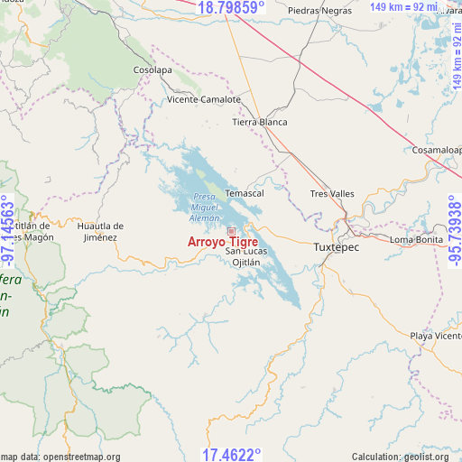
Arroyo Tigre GPS coordinates[2]
18° 7' 54.012" North, 96° 26' 33" West
| Map corner | latitude | longitude |
|---|---|---|
| Upper-left | 18.79859°, | -97.14563° |
| Center: | 18.13167°, | -96.4425° |
| Lower-right: | 17.4622°, | -95.73938° |
| Map W x H: | 148.6×148.6 km | = 92.3×92.3mi |
| max Lat: | 32.7° ⇑77.2% North |
| Arroyo Tigre: | 18.13167° |
| min Lat: | ⇓22.8% South 14.53588° |
| min Long | Arroyo Tigre | max Long |
| -117.105° | -96.4425° | -86.73105° |
| W 80%⇐ | ⇒20% E |
Elevation
Elevation of Arroyo Tigre is 104 m = 341 ft, and this is 1149.7 m = 3772 ft below average elevation for this country.
| Max E: |
3497 m = 11473 ft | 79.4% |
| Avg. | 1253.7 m = 4113 ft | |
| Arroyo Tigre | 104 m = 341 ft | |
Min E: |
-1 m = -3 ft | 20.6% |
See also: Mexico elevation on elevation.city.
Geographical zone
Arroyo Tigre is located in North Torrid zone (between Equator and Tropic of Cancer). Distance of this Northern Tropic circle is 589.9 km =366.5 mi to North.| Distance of | km | miles | from Arroyo Tigre |
|---|---|---|---|
| North Pole | 7991 | 4965.4 | to North |
| Arctic Circle | 5385.1 | 3346.1 | to North |
| Tropic Cancer | 589.9 | 366.5 | to North |
| Equator | 2016.1 | 1252.7 | to South |


Nearby cities:
15 places around Arroyo Tigre: (largest is in red/bold)
• Agua de Tierra (Sección la Montaña)
8.3 km =5.2 mi,  233°
233°
• Arroyo Camalote
6 km =3.7 mi,  141°
141°
• Arroyo Grande
6.9 km =4.3 mi,  238°
238°
• Benito Juárez II (San Martín)
2.2 km =1.4 mi,  296°
296°
• Isla Soyaltepec
8.8 km =5.5 mi,  330°
330°
• La Permuta
6.4 km =4 mi, 230°
• Laguna Arroyo Grande
5.6 km =3.5 mi,  156°
156°
• Loma de Piedra
3.8 km =2.4 mi,  175°
175°
• Los Zarates
8 km =5 mi,  249°
249°
• Nuevo Pescadito de Abajo Dos
4.7 km =2.9 mi,  68°
68°
• Piedra de Amolar
1.6 km =1 mi,  215°
215°
• Playa de Soyaltepec
3.6 km =2.2 mi,  132°
132°
• San José Lagunas
6.5 km =4 mi,  107°
107°
• San Pedro Ixcatlán
7.3 km =4.5 mi,  282°
282°
• Sección los Roques
7.3 km =4.5 mi, 245°
Sources, notices
• [Note1] Compared only with cities in Mexico existing in our database
• [Src1] Map data: © OpenStreetMap contributors (CC-BY-SA)
• [Src2] Other city data from geonames.org with taken over terms of usage.
• [Src3] Geographical zone / Annual Mean Temperature by Robert A. Rohde @ Wikipedia
