Isla Soyaltepec geodata
Isla Soyaltepec (Oaxaca) is a populated place; located in Mexico in America/Mexico_City (GMT-6) time zone. With population of 8,116 people, there are 1168 cities with bigger population in this country. Compared to other cities in Mexico, 76.2% of cities are located further ↑North; 79.8% of cities are located further ←West and 75.4% of cities have higher elevation than Isla Soyaltepec. Note1


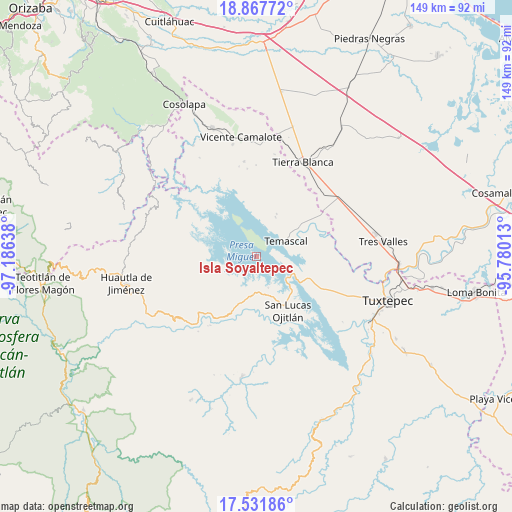
Isla Soyaltepec GPS coordinates[2]
18° 12' 3.852" North, 96° 28' 59.7" West
| Map corner | latitude | longitude |
|---|---|---|
| Upper-left | 18.86772°, | -97.18638° |
| Center: | 18.20107°, | -96.48325° |
| Lower-right: | 17.53186°, | -95.78013° |
| Map W x H: | 148.5×148.5 km | = 92.3×92.3mi |
| max Lat: | 32.7° ⇑76.2% North |
| Isla Soyaltepec: | 18.20107° |
| min Lat: | ⇓23.8% South 14.53588° |
| min Long | Isla Soyaltepec | max Long |
| -117.105° | -96.48325° | -86.73105° |
| W 79.8%⇐ | ⇒20.2% E |
Elevation
Elevation of Isla Soyaltepec is 208 m = 682 ft, and this is 1045.7 m = 3431 ft below average elevation for this country.
| Max E: |
3497 m = 11473 ft | 75.4% |
| Avg. | 1253.7 m = 4113 ft | |
| Isla Soyaltepec | 208 m = 682 ft | |
Min E: |
-1 m = -3 ft | 24.6% |
See also: Mexico elevation on elevation.city.
Geographical zone
Isla Soyaltepec is located in North Torrid zone (between Equator and Tropic of Cancer). Distance of this Northern Tropic circle is 582.1 km =361.7 mi to North.| Distance of | km | miles | from Isla Soyaltepec |
|---|---|---|---|
| North Pole | 7983.3 | 4960.6 | to North |
| Arctic Circle | 5377.4 | 3341.4 | to North |
| Tropic Cancer | 582.1 | 361.7 | to North |
| Equator | 2023.8 | 1257.5 | to South |


Nearby cities:
15 places around Isla Soyaltepec: (largest is in red/bold)
• Arroyo Grande
11.5 km =7.1 mi,  187°
187°
• Arroyo Murciélago
9.1 km =5.7 mi,  228°
228°
• Arroyo Tigre
8.8 km =5.5 mi,  150°
150°
• Benito Juárez II (San Martín)
7.1 km =4.4 mi,  161°
161°
• Cerro Quemado
11 km =6.8 mi,  241°
241°
• El Encajonado
11.1 km =6.9 mi,  66°
66°
• El Progreso
10.7 km =6.6 mi,  218°
218°
• Los Zarates
11 km =6.8 mi,  196°
196°
• Nuevo Paso Nacional
10.3 km =6.4 mi,  62°
62°
• Nuevo Pescadito de Abajo Dos
10.6 km =6.6 mi,  124°
124°
• Piedra de Amolar
9.6 km =6 mi, 159°
• San Felipe Tílpam
11 km =6.8 mi,  262°
262°
• San Pedro Ixcatlán
6.7 km =4.2 mi, 204°
• Sección los Roques
11 km =6.8 mi, 192°
• Temascal
9.8 km =6.1 mi, 61°
Sources, notices
• [Note1] Compared only with cities in Mexico existing in our database
• [Src1] Map data: © OpenStreetMap contributors (CC-BY-SA)
• [Src2] Other city data from geonames.org with taken over terms of usage.
• [Src3] Geographical zone / Annual Mean Temperature by Robert A. Rohde @ Wikipedia
