El Chupadero geodata
El Chupadero (Michoacán) is a populated place; located in Mexico in America/Mexico_City (GMT-6) time zone. With population of 542 people, there are 15673 cities with bigger population in this country. Compared to other cities in Mexico, 61.5% of cities are located further ↑North; 78.4% of cities are located further →East and 84% of cities have lower elevation than El Chupadero. Note1


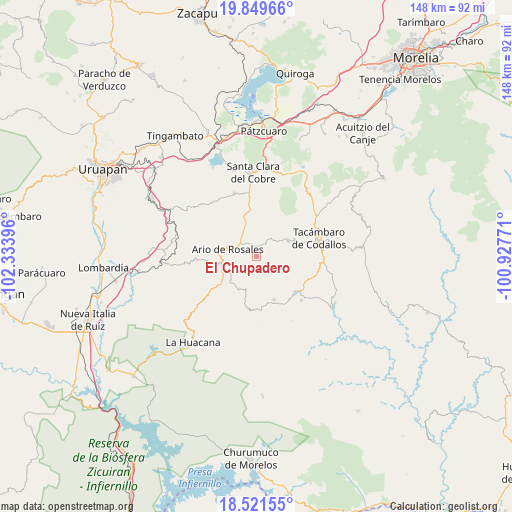
El Chupadero GPS coordinates[2]
19° 11' 12.984" North, 101° 37' 50.988" West
| Map corner | latitude | longitude |
|---|---|---|
| Upper-left | 19.84966°, | -102.33396° |
| Center: | 19.18694°, | -101.63083° |
| Lower-right: | 18.52155°, | -100.92771° |
| Map W x H: | 147.7×147.7 km | = 91.8×91.8mi |
| max Lat: | 32.7° ⇑61.5% North |
| El Chupadero: | 19.18694° |
| min Lat: | ⇓38.5% South 14.53588° |
| min Long | El Chupadero | max Long |
| -117.105° | -101.63083° | -86.73105° |
| W 21.6%⇐ | ⇒78.4% E |
Elevation
Elevation of El Chupadero is 2243 m = 7359 ft, and this is 989.3 m = 3246 ft above average elevation for this country.
| Max E: |
3497 m = 11473 ft | 16% |
| El Chupadero | 2243 m 7359 ft | |
| Avg. | 1253.7 m = 4113 ft | |
Min E: |
-1 m = -3 ft | 84% |
See also: Mexico elevation on elevation.city.
Geographical zone
El Chupadero is located in North Torrid zone (between Equator and Tropic of Cancer). Distance of this Northern Tropic circle is 472.5 km =293.6 mi to North.| Distance of | km | miles | from El Chupadero |
|---|---|---|---|
| North Pole | 7873.7 | 4892.5 | to North |
| Arctic Circle | 5267.8 | 3273.3 | to North |
| Tropic Cancer | 472.5 | 293.6 | to North |
| Equator | 2133.4 | 1325.6 | to South |


Nearby cities:
15 places around El Chupadero: (largest is in red/bold)
• Ario de Rosales
8.4 km =5.2 mi,  286°
286°
• Doctor Miguel Silva Macías
10.4 km =6.5 mi,  256°
256°
• El Cahulote de Santa Ana
13.3 km =8.3 mi,  157°
157°
• El Tepamal
6.2 km =3.9 mi,  14°
14°
• El Terrero
12.2 km =7.6 mi,  66°
66°
• Los Hacheros
8.2 km =5.1 mi,  128°
128°
• Los Tumines
10.4 km =6.5 mi,  250°
250°
• Pablo Cuin
5 km =3.1 mi,  319°
319°
• Pinal Grande
11.2 km =7 mi,  148°
148°
• San José Grande
8.4 km =5.2 mi,  61°
61°
• San Rafael Tecario
13.3 km =8.3 mi,  78°
78°
• Santas Marías
13.5 km =8.4 mi, 55°
• Tecario
10.4 km =6.5 mi, 60°
• Urapa
10.4 km =6.5 mi,  208°
208°
• Zatzio (Tzatzio)
4.8 km =3 mi,  37°
37°
Sources, notices
• [Note1] Compared only with cities in Mexico existing in our database
• [Src1] Map data: © OpenStreetMap contributors (CC-BY-SA)
• [Src2] Other city data from geonames.org with taken over terms of usage.
• [Src3] Geographical zone / Annual Mean Temperature by Robert A. Rohde @ Wikipedia
