Rancho Pastor geodata
Rancho Pastor (Oaxaca) is a populated place; located in Mexico in America/Mexico_City (GMT-6) time zone. With population of 509 people, there are 16517 cities with bigger population in this country. Compared to other cities in Mexico, 85.9% of cities are located further ↑North; 60.6% of cities are located further ←West and 61.1% of cities have lower elevation than Rancho Pastor. Note1


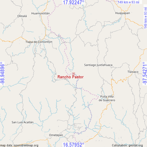
Rancho Pastor GPS coordinates[2]
17° 15' 7.992" North, 98° 14' 44.988" West
| Map corner | latitude | longitude |
|---|---|---|
| Upper-left | 17.92247°, | -98.94896° |
| Center: | 17.25222°, | -98.24583° |
| Lower-right: | 16.57952°, | -97.54271° |
| Map W x H: | 149.3×149.3 km | = 92.8×92.8mi |
| max Lat: | 32.7° ⇑85.9% North |
| Rancho Pastor: | 17.25222° |
| min Lat: | ⇓14.1% South 14.53588° |
| min Long | Rancho Pastor | max Long |
| -117.105° | -98.24583° | -86.73105° |
| W 60.6%⇐ | ⇒39.4% E |
Elevation
Elevation of Rancho Pastor is 1746 m = 5728 ft, and this is 492.3 m = 1615 ft above average elevation for this country.
| Max E: |
3497 m = 11473 ft | 38.9% |
| Rancho Pastor | 1746 m 5728 ft | |
| Avg. | 1253.7 m = 4113 ft | |
Min E: |
-1 m = -3 ft | 61.1% |
See also: Mexico elevation on elevation.city.
Geographical zone
Rancho Pastor is located in North Torrid zone (between Equator and Tropic of Cancer). Distance of this Northern Tropic circle is 687.7 km =427.3 mi to North.| Distance of | km | miles | from Rancho Pastor |
|---|---|---|---|
| North Pole | 8088.8 | 5026.1 | to North |
| Arctic Circle | 5482.9 | 3406.9 | to North |
| Tropic Cancer | 687.7 | 427.3 | to North |
| Equator | 1918.3 | 1192 | to South |


Nearby cities:
15 places around Rancho Pastor: (largest is in red/bold)
• Coyul
9.9 km =6.2 mi,  147°
147°
• El Jicaral
14.9 km =9.3 mi,  159°
159°
• El Limón Guadalupe
12.3 km =7.6 mi,  176°
176°
• Jicayán de Tovar
13.9 km =8.6 mi, 175°
• San Juan Piñas
11.3 km =7 mi,  106°
106°
• San Marcos Xinicuesta
14.3 km =8.9 mi,  71°
71°
• San Martín Peras
11.9 km =7.4 mi,  4°
4°
• San Miguel Peras
8 km =5 mi, 4°
• San Miguel el Grande
1.3 km =0.8 mi,  125°
125°
• San Pablo Atzompa
13.2 km =8.2 mi,  267°
267°
• San Vicente Zoyatlán
14.8 km =9.2 mi,  301°
301°
• Santiago Petlacala
6.9 km =4.3 mi,  319°
319°
• Santiago Tilapa
1.8 km =1.1 mi,  294°
294°
• Santos Reyes Zochiquilazola
6.8 km =4.2 mi,  76°
76°
• Tierra Colorada
12.2 km =7.6 mi, 155°
Sources, notices
• [Note1] Compared only with cities in Mexico existing in our database
• [Src1] Map data: © OpenStreetMap contributors (CC-BY-SA)
• [Src2] Other city data from geonames.org with taken over terms of usage.
• [Src3] Geographical zone / Annual Mean Temperature by Robert A. Rohde @ Wikipedia
