San Miguel Tlapéxcatl geodata
San Miguel Tlapéxcatl (Veracruz) is a populated place; located in Mexico in America/Mexico_City (GMT-6) time zone. With population of 993 people, there are 8774 cities with bigger population in this country. Compared to other cities in Mexico, 58.7% of cities are located further ↑North; 74.9% of cities are located further ←West and 54.1% of cities have higher elevation than San Miguel Tlapéxcatl. Note1
Current local time in San Miguel Tlapéxcatl:
05:16 AM, WednesdayDifference from your time zone: hours


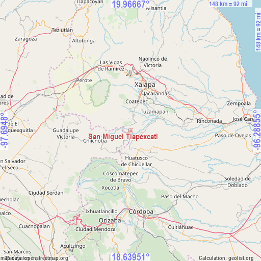
San Miguel Tlapéxcatl GPS coordinates[2]
19° 18' 15.984" North, 96° 59' 30.012" West
| Map corner | latitude | longitude |
|---|---|---|
| Upper-left | 19.96667°, | -97.6948° |
| Center: | 19.30444°, | -96.99167° |
| Lower-right: | 18.63951°, | -96.28855° |
| Map W x H: | 147.6×147.6 km | = 91.7×91.7mi |
| max Lat: | 32.7° ⇑58.7% North |
| San Miguel Tlapéxcatl: | 19.30444° |
| min Lat: | ⇓41.3% South 14.53588° |
| min Long | San Miguel Tlap | max Long |
| -117.105° | -96.99167° | -86.73105° |
| W 74.9%⇐ | ⇒25.1% E |
Elevation
Elevation of San Miguel Tlapéxcatl is 1235 m = 4052 ft, and this is 18.7 m = 61 ft below average elevation for this country.
| Max E: |
3497 m = 11473 ft | 54.1% |
| Avg. | 1253.7 m = 4113 ft | |
| San Miguel Tlapéxcatl | 1235 m = 4052 ft | |
Min E: |
-1 m = -3 ft | 45.9% |
See also: Mexico elevation on elevation.city.
Geographical zone
San Miguel Tlapéxcatl is located in North Torrid zone (between Equator and Tropic of Cancer). Distance of this Northern Tropic circle is 459.5 km =285.5 mi to North.| Distance of | km | miles | from San Miguel Tlapéxcatl |
|---|---|---|---|
| North Pole | 7860.6 | 4884.3 | to North |
| Arctic Circle | 5254.7 | 3265.1 | to North |
| Tropic Cancer | 459.5 | 285.5 | to North |
| Equator | 2146.5 | 1333.8 | to South |


Nearby cities:
15 places around San Miguel Tlapéxcatl: (largest is in red/bold)
• Barranca Nueva
6.2 km =3.9 mi,  306°
306°
• Baxtla
6.7 km =4.2 mi,  13°
13°
• Casa Quemada
3.9 km =2.4 mi,  318°
318°
• Cetlalpan
7.9 km =4.9 mi, 323°
• Cosautlán
3.1 km =1.9 mi,  2°
2°
• Emiliano Zapata
1.7 km =1.1 mi,  108°
108°
• Huehuetecpan
2 km =1.2 mi,  330°
330°
• La Reforma
6.1 km =3.8 mi,  67°
67°
• Limones
8.1 km =5 mi,  62°
62°
• Ohuapan
6 km =3.7 mi,  175°
175°
• Piedra Parada
5.7 km =3.5 mi,  35°
35°
• Pinillo
5.7 km =3.5 mi,  102°
102°
• San Martín Comalapa
3.8 km =2.4 mi,  193°
193°
• Texin
7 km =4.3 mi,  348°
348°
• Vaquería
4.1 km =2.5 mi, 69°
Sources, notices
• [Note1] Compared only with cities in Mexico existing in our database
• [Src1] Map data: © OpenStreetMap contributors (CC-BY-SA)
• [Src2] Other city data from geonames.org with taken over terms of usage.
• [Src3] Geographical zone / Annual Mean Temperature by Robert A. Rohde @ Wikipedia
