Parit Raja geodata
Parit Raja (Johor) is a populated place; located in Malaysia in Asia/Kuala_Lumpur (GMT+8) time zone. With population of 17,441 people, there are 130 cities with bigger population in this country. Compared to other cities in Malaysia, 92.1% of cities are located further ↑North; 69.7% of cities are located further ←West and 70.8% of cities have higher elevation than Parit Raja. Note1


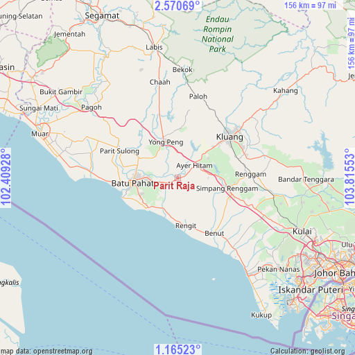
Parit Raja GPS coordinates[2]
1° 52' 5.16" North, 103° 6' 44.64" East
| Map corner | latitude | longitude |
|---|---|---|
| Upper-left | 2.57069°, | 102.40928° |
| Center: | 1.8681°, | 103.1124° |
| Lower-right: | 1.16523°, | 103.81553° |
| Map W x H: | 156.3×156.3 km | = 97.1×97.1mi |
| max Lat: | 6.88732° ⇑92.1% North |
| Parit Raja: | 1.8681° |
| min Lat: | ⇓7.9% South 1.24722° |
| min Long | Parit Raja | max Long |
| 99.68252° | 103.1124° | 118.61119° |
| W 69.7%⇐ | ⇒30.3% E |
Elevation
Elevation of Parit Raja is 9 m = 30 ft, and this is 35.7 m = 117 ft below average elevation for this country.
| Max E: |
1488 m = 4882 ft | 70.8% |
| Avg. | 44.7 m = 147 ft | |
| Parit Raja | 9 m = 30 ft | |
Min E: |
0 m = 0 ft | 29.2% |
See also: Malaysia elevation on elevation.city.
Geographical zone
Parit Raja is located in North Torrid zone (between Equator and Tropic of Cancer). Distance of Equator is 207.7 km =129.1 mi to South.| Distance of | km | miles | from Parit Raja |
|---|---|---|---|
| North Pole | 9799.3 | 6089 | to North |
| Arctic Circle | 7193.5 | 4469.8 | to North |
| Tropic Cancer | 2398.2 | 1490.2 | to North |
| Equator | 207.7 | 129.1 | to South |


Nearby cities:
15 places around Parit Raja: (largest is in red/bold)
• Bakri
54.7 km =34 mi,  290°
290°
• Batu Pahat
20 km =12.4 mi,  265°
265°
• Chaah
43 km =26.7 mi,  350°
350°
• Kampung Simpang Renggam
21.3 km =13.2 mi,  102°
102°
• Kelapa Sawit
51.7 km =32.1 mi,  115°
115°
• Kluang
29 km =18 mi,  51°
51°
• Kulai
59.4 km =36.9 mi,  113°
113°
• Labis
58.4 km =36.3 mi, 349°
• Muar
63.5 km =39.5 mi, 287°
• Pekan Nenas
59.8 km =37.2 mi,  131°
131°
• Pontian Kechil
52.4 km =32.6 mi,  144°
144°
• Skudai
70.9 km =44.1 mi, 121°
• Taman Senai
65.9 km =40.9 mi, 116°
• Tangkak
77.1 km =47.9 mi,  305°
305°
• Yong Peng
17 km =10.6 mi,  342°
342°
Sources, notices
• [Note1] Compared only with cities in Malaysia existing in our database
• [Src1] Map data: © OpenStreetMap contributors (CC-BY-SA)
• [Src2] Other city data from geonames.org with taken over terms of usage.
• [Src3] Geographical zone / Annual Mean Temperature by Robert A. Rohde @ Wikipedia
