Chaah geodata
Chaah (Johor) is a populated place; located in Malaysia in Asia/Kuala_Lumpur (GMT+8) time zone. With population of 11,844 people, there are 155 cities with bigger population in this country. Compared to other cities in Malaysia, 85.4% of cities are located further ↑North; 68.5% of cities are located further ←West and 65.2% of cities have lower elevation than Chaah. Note1


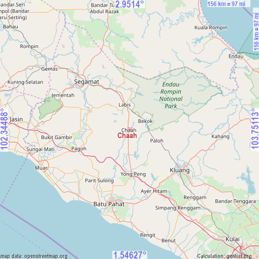
Chaah GPS coordinates[2]
2° 14' 56.4" North, 103° 2' 52.8" East
| Map corner | latitude | longitude |
|---|---|---|
| Upper-left | 2.9514°, | 102.34488° |
| Center: | 2.249°, | 103.048° |
| Lower-right: | 1.54627°, | 103.75113° |
| Map W x H: | 156.2×156.2 km | = 97.1×97.1mi |
| max Lat: | 6.88732° ⇑85.4% North |
| Chaah: | 2.249° |
| min Lat: | ⇓14.6% South 1.24722° |
| min Long | Chaah | max Long |
| 99.68252° | 103.048° | 118.61119° |
| W 68.5%⇐ | ⇒31.5% E |
Elevation
Elevation of Chaah is 24 m = 79 ft, and this is 20.7 m = 68 ft below average elevation for this country.
| Max E: |
1488 m = 4882 ft | 34.8% |
| Avg. | 44.7 m = 147 ft | |
| Chaah | 24 m = 79 ft | |
Min E: |
0 m = 0 ft | 65.2% |
See also: Malaysia elevation on elevation.city.
Geographical zone
Chaah is located in North Torrid zone (between Equator and Tropic of Cancer). Distance of Equator is 250.1 km =155.4 mi to South.| Distance of | km | miles | from Chaah |
|---|---|---|---|
| North Pole | 9757 | 6062.7 | to North |
| Arctic Circle | 7151.1 | 4443.5 | to North |
| Tropic Cancer | 2355.9 | 1463.9 | to North |
| Equator | 250.1 | 155.4 | to South |


Nearby cities:
15 places around Chaah: (largest is in red/bold)
• Bakri
49.5 km =30.8 mi,  242°
242°
• Batu Pahat
45.7 km =28.4 mi,  196°
196°
• Bemban
74.8 km =46.5 mi,  271°
271°
• Buloh Kasap
46.3 km =28.8 mi,  317°
317°
• Kampung Ayer Molek
80.1 km =49.8 mi, 267°
• Kampung Bukit Baharu
84.8 km =52.7 mi, 267°
• Kampung Simpang Renggam
54.6 km =33.9 mi,  149°
149°
• Kelapa Sawit
84 km =52.2 mi,  140°
140°
• Kluang
38.5 km =23.9 mi,  129°
129°
• Labis
15.4 km =9.6 mi,  348°
348°
• Muar
57.9 km =36 mi,  246°
246°
• Parit Raja
43 km =26.7 mi,  170°
170°
• Segamat
39.2 km =24.4 mi, 318°
• Tangkak
55.9 km =34.7 mi, 272°
• Yong Peng
26.2 km =16.3 mi,  175°
175°
Sources, notices
• [Note1] Compared only with cities in Malaysia existing in our database
• [Src1] Map data: © OpenStreetMap contributors (CC-BY-SA)
• [Src2] Other city data from geonames.org with taken over terms of usage.
• [Src3] Geographical zone / Annual Mean Temperature by Robert A. Rohde @ Wikipedia
