Kampung Pasir Gudang Baru geodata
Kampung Pasir Gudang Baru (Johor) is a populated place; located in Malaysia in Asia/Kuala_Lumpur (GMT+8) time zone. With population of 145,639 people, there are 30 cities with bigger population in this country. Compared to other cities in Malaysia, 98.9% of cities are located further ↑North; 80.3% of cities are located further ←West and 64.6% of cities have higher elevation than Kampung Pasir Gudang Baru. Note1
Current local time in Kampung Pasir Gudang Baru:
04:45 PM, MondayDifference from your time zone: hours


Kampung Pasir Gudang Baru GPS coordinates[2]
1° 28' 21.36" North, 103° 52' 40.8" East
| Map corner | latitude | longitude |
|---|---|---|
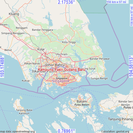
| Upper-left | 2.17536°, | 103.17488° |
| Center: | 1.4726°, | 103.878° |
| Lower-right: | 0.76961°, | 104.58113° |
| Map W x H: | 156.3×156.3 km | = 97.1×97.1mi |
| max Lat: | 6.88732° ⇑98.9% North |
| Kampung Pasir Gudang Baru: | 1.4726° |
| min Lat: | ⇓1.1% South 1.24722° |
| min Long | Kampung Pasir G | max Long |
| 99.68252° | 103.878° | 118.61119° |
| W 80.3%⇐ | ⇒19.7% E |
Elevation
Elevation of Kampung Pasir Gudang Baru is 10 m = 33 ft, and this is 34.7 m = 114 ft below average elevation for this country.
| Max E: |
1488 m = 4882 ft | 64.6% |
| Avg. | 44.7 m = 147 ft | |
| Kampung Pasir Gudang Baru | 10 m = 33 ft | |
Min E: |
0 m = 0 ft | 35.4% |
See also: Kampung Pasir Gudang Baru elevation on elevation.city.
Geographical zone
Kampung Pasir Gudang Baru is located in North Torrid zone (between Equator and Tropic of Cancer). Distance of Equator is 163.7 km =101.7 mi to South.| Distance of | km | miles | from Kampung Pasir Gudang Baru |
|---|---|---|---|
| North Pole | 9843.3 | 6116.3 | to North |
| Arctic Circle | 7237.4 | 4497.1 | to North |
| Tropic Cancer | 2442.2 | 1517.5 | to North |
| Equator | 163.7 | 101.7 | to South |


Nearby cities:
15 places around Kampung Pasir Gudang Baru: (largest is in red/bold)
• Batu Pahat
113.4 km =70.5 mi,  292°
292°
• Johor Bahru
13.4 km =8.3 mi,  266°
266°
• Kampung Simpang Renggam
75.4 km =46.9 mi,  301°
301°
• Kelapa Sawit
44.2 km =27.5 mi, 299°
• Kluang
88 km =54.7 mi,  314°
314°
• Kota Tinggi
29.6 km =18.4 mi,  4°
4°
• Kulai
36.7 km =22.8 mi, 303°
• Mersing
106.7 km =66.3 mi,  357°
357°
• Parit Raja
95.8 km =59.5 mi, 297°
• Pekan Nenas
40.7 km =25.3 mi,  275°
275°
• Pontian Kechil
54.3 km =33.7 mi, 271°
• Skudai
25.5 km =15.8 mi, 286°
• Taman Senai
29.9 km =18.6 mi, 298°
• Ulu Tiram
15.7 km =9.8 mi,  334°
334°
• Yong Peng
108.5 km =67.4 mi, 303°
Sources, notices
• [Note1] Compared only with cities in Malaysia existing in our database
• [Src1] Map data: © OpenStreetMap contributors (CC-BY-SA)
• [Src2] Other city data from geonames.org with taken over terms of usage.
• [Src3] Geographical zone / Annual Mean Temperature by Robert A. Rohde @ Wikipedia
