Olupona geodata
Olupona (Osun) is a populated place; located in Nigeria in Africa/Lagos (GMT+1) time zone. With population of 95,002 people, there are 91 cities with bigger population in this country. Compared to other cities in Nigeria, 59.2% of cities are located further ↑North; 90.6% of cities are located further →East and 55.9% of cities have higher elevation than Olupona. Note1


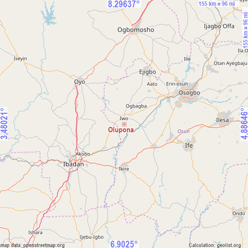
Olupona GPS coordinates[2]
7° 36' 0" North, 4° 10' 59.988" East
| Map corner | latitude | longitude |
|---|---|---|
| Upper-left | 8.29637°, | 3.48021° |
| Center: | 7.6°, | 4.18333° |
| Lower-right: | 6.9025°, | 4.88646° |
| Map W x H: | 155×155 km | = 96.3×96.3mi |
| max Lat: | 13.7543° ⇑59.2% North |
| Olupona: | 7.6° |
| min Lat: | ⇓40.8% South 4.31231° |
| min Long | Olupona | max Long |
| 2.73333° | 4.18333° | 14.46552° |
| W 9.4%⇐ | ⇒90.6% E |
Elevation
Elevation of Olupona is 241 m = 791 ft, and this is 55.5 m = 182 ft below average elevation for this country.
| Max E: |
1599 m = 5246 ft | 55.9% |
| Avg. | 296.5 m = 973 ft | |
| Olupona | 241 m = 791 ft | |
Min E: |
2 m = 7 ft | 44.1% |
See also: Olupona elevation on elevation.city.
Geographical zone
Olupona is located in North Torrid zone (between Equator and Tropic of Cancer). Distance of Equator is 845 km =525.1 mi to South.| Distance of | km | miles | from Olupona |
|---|---|---|---|
| North Pole | 9162 | 5693 | to North |
| Arctic Circle | 6556.1 | 4073.8 | to North |
| Tropic Cancer | 1760.9 | 1094.2 | to North |
| Equator | 845 | 525.1 | to South |


Nearby cities:
15 places around Olupona: (largest is in red/bold)
• Apomu
27.6 km =17.1 mi,  179°
179°
• Awo
29.9 km =18.6 mi,  51°
51°
• Bode Osi
17.6 km =10.9 mi,  16°
16°
• Ede
31.6 km =19.6 mi,  61°
61°
• Egbeda
28.8 km =17.9 mi,  210°
210°
• Fiditi
31.9 km =19.8 mi,  293°
293°
• Gbongan
23.2 km =14.4 mi,  126°
126°
• Ikire
25.6 km =15.9 mi, 179°
• Ile-Ogbo
7.2 km =4.5 mi,  70°
70°
• Ipetumodu
30.1 km =18.7 mi,  106°
106°
• Iwo
3.9 km =2.4 mi,  357°
357°
• Iyana-Ofa
15.9 km =9.9 mi,  225°
225°
• Lalupon
19.6 km =12.2 mi,  221°
221°
• Modakeke
25.6 km =15.9 mi,  160°
160°
• Moniya
31 km =19.3 mi,  255°
255°
Sources, notices
• [Note1] Compared only with cities in Nigeria existing in our database
• [Src1] Map data: © OpenStreetMap contributors (CC-BY-SA)
• [Src2] Other city data from geonames.org with taken over terms of usage.
• [Src3] Geographical zone / Annual Mean Temperature by Robert A. Rohde @ Wikipedia
