Modakeke geodata
Modakeke (Osun) is a populated place; located in Nigeria in Africa/Lagos (GMT+1) time zone. With population of 119,529 people, there are 69 cities with bigger population in this country. Compared to other cities in Nigeria, 63.6% of cities are located further ↑North; 89.5% of cities are located further →East and 57.3% of cities have higher elevation than Modakeke. Note1


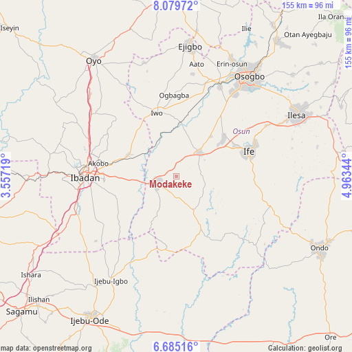
Modakeke GPS coordinates[2]
7° 22' 58.764" North, 4° 15' 37.116" East
| Map corner | latitude | longitude |
|---|---|---|
| Upper-left | 8.07972°, | 3.55719° |
| Center: | 7.38299°, | 4.26031° |
| Lower-right: | 6.68516°, | 4.96344° |
| Map W x H: | 155.1×155.1 km | = 96.4×96.4mi |
| max Lat: | 13.7543° ⇑63.6% North |
| Modakeke: | 7.38299° |
| min Lat: | ⇓36.4% South 4.31231° |
| min Long | Modakeke | max Long |
| 2.73333° | 4.26031° | 14.46552° |
| W 10.5%⇐ | ⇒89.5% E |
Elevation
Elevation of Modakeke is 228 m = 748 ft, and this is 68.5 m = 225 ft below average elevation for this country.
| Max E: |
1599 m = 5246 ft | 57.3% |
| Avg. | 296.5 m = 973 ft | |
| Modakeke | 228 m = 748 ft | |
Min E: |
2 m = 7 ft | 42.7% |
See also: Modakeke elevation on elevation.city.
Geographical zone
Modakeke is located in North Torrid zone (between Equator and Tropic of Cancer). Distance of Equator is 820.9 km =510.1 mi to South.| Distance of | km | miles | from Modakeke |
|---|---|---|---|
| North Pole | 9186.2 | 5708 | to North |
| Arctic Circle | 6580.3 | 4088.8 | to North |
| Tropic Cancer | 1785 | 1109.1 | to North |
| Equator | 820.9 | 510.1 | to South |


Nearby cities:
15 places around Modakeke: (largest is in red/bold)
• Akanran
28.3 km =17.6 mi,  246°
246°
• Apomu
9.2 km =5.7 mi, 247°
• Bode Osi
41.1 km =25.5 mi,  355°
355°
• Egbeda
23.2 km =14.4 mi,  268°
268°
• Gbongan
14.7 km =9.1 mi,  44°
44°
• Ibadan
39.1 km =24.3 mi, 269°
• Ikire
8.3 km =5.2 mi,  259°
259°
• Ile-Ife
34.9 km =21.7 mi,  71°
71°
• Ile-Ogbo
26.5 km =16.5 mi, 356°
• Ipetumodu
25.5 km =15.8 mi,  52°
52°
• Iwo
29.4 km =18.3 mi,  342°
342°
• Iyana-Ofa
23.6 km =14.7 mi,  303°
303°
• Lalupon
23.4 km =14.5 mi,  293°
293°
• Moniya
41.7 km =25.9 mi, 292°
• Olupona
25.6 km =15.9 mi, 340°
Sources, notices
• [Note1] Compared only with cities in Nigeria existing in our database
• [Src1] Map data: © OpenStreetMap contributors (CC-BY-SA)
• [Src2] Other city data from geonames.org with taken over terms of usage.
• [Src3] Geographical zone / Annual Mean Temperature by Robert A. Rohde @ Wikipedia
