Okeho geodata
Okeho (Oyo) is a seat of a second-order administrative division; located in Nigeria in Africa/Lagos (GMT+1) time zone. With population of 12,964 people, there are 274 cities with bigger population in this country. Compared to other cities in Nigeria, 52.6% of cities are located further ↑North; 97.3% of cities are located further →East and 72.8% of cities have lower elevation than Okeho. Note1


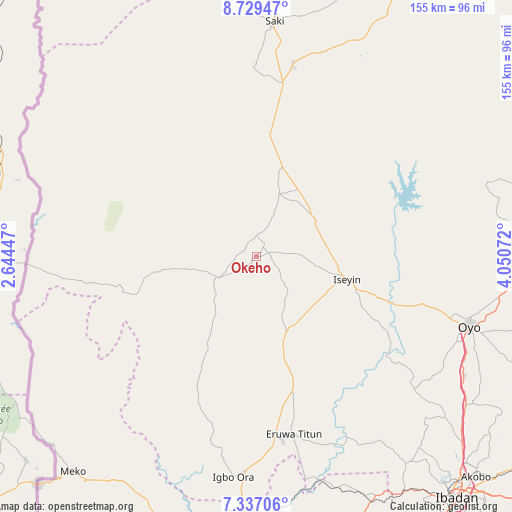
Okeho GPS coordinates[2]
8° 2' 1.896" North, 3° 20' 51.324" East
| Map corner | latitude | longitude |
|---|---|---|
| Upper-left | 8.72947°, | 2.64447° |
| Center: | 8.03386°, | 3.34759° |
| Lower-right: | 7.33706°, | 4.05072° |
| Map W x H: | 154.8×154.8 km | = 96.2×96.2mi |
| max Lat: | 13.7543° ⇑52.6% North |
| Okeho: | 8.03386° |
| min Lat: | ⇓47.4% South 4.31231° |
| min Long | Okeho | max Long |
| 2.73333° | 3.34759° | 14.46552° |
| W 2.7%⇐ | ⇒97.3% E |
Elevation
Elevation of Okeho is 417 m = 1368 ft, and this is 120.5 m = 395 ft above average elevation for this country.
| Max E: |
1599 m = 5246 ft | 27.2% |
| Okeho | 417 m 1368 ft | |
| Avg. | 296.5 m = 973 ft | |
Min E: |
2 m = 7 ft | 72.8% |
See also: Nigeria elevation on elevation.city.
Geographical zone
Okeho is located in North Torrid zone (between Equator and Tropic of Cancer). Distance of Equator is 893.3 km =555.1 mi to South.| Distance of | km | miles | from Okeho |
|---|---|---|---|
| North Pole | 9113.8 | 5663.1 | to North |
| Arctic Circle | 6507.9 | 4043.8 | to North |
| Tropic Cancer | 1712.6 | 1064.2 | to North |
| Equator | 893.3 | 555.1 | to South |


Nearby cities:
15 places around Okeho: (largest is in red/bold)
• Ago Are
52.4 km =32.6 mi,  8°
8°
• Ago-Amodu
71.8 km =44.6 mi,  24°
24°
• Ayete
56.3 km =35 mi,  194°
194°
• Eruwa
56.2 km =34.9 mi,  172°
172°
• Fiditi
72.1 km =44.8 mi,  119°
119°
• Ido
77.2 km =48 mi,  144°
144°
• Igbo-Ora
67 km =41.6 mi, 185°
• Iseyin
28.3 km =17.6 mi,  104°
104°
• Iwere-Ile
28.8 km =17.9 mi,  262°
262°
• Jobele
69.8 km =43.4 mi, 115°
• Orita Eruwa
54.6 km =33.9 mi, 170°
• Otu
20.3 km =12.6 mi, 18°
• Oyo
67.4 km =41.9 mi,  107°
107°
• Saki
70.7 km =43.9 mi,  4°
4°
• Tede
59.1 km =36.7 mi, 10°
Sources, notices
• [Note1] Compared only with cities in Nigeria existing in our database
• [Src1] Map data: © OpenStreetMap contributors (CC-BY-SA)
• [Src2] Other city data from geonames.org with taken over terms of usage.
• [Src3] Geographical zone / Annual Mean Temperature by Robert A. Rohde @ Wikipedia
