Ayete geodata
Ayete (Oyo) is a seat of a second-order administrative division; located in Nigeria in Africa/Lagos (GMT+1) time zone. In our database, there are 451 cities with bigger population. Compared to other cities in Nigeria, 60.3% of cities are located further ↑North; 98.7% of cities are located further →East and 70.6% of cities have higher elevation than Ayete. Note1


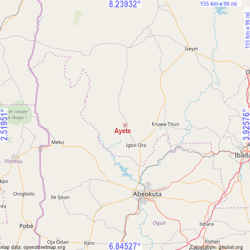
Ayete GPS coordinates[2]
7° 32' 34.296" North, 3° 13' 21.468" East
| Map corner | latitude | longitude |
|---|---|---|
| Upper-left | 8.23932°, | 2.51951° |
| Center: | 7.54286°, | 3.22263° |
| Lower-right: | 6.84527°, | 3.92576° |
| Map W x H: | 155×155 km | = 96.3×96.3mi |
| max Lat: | 13.7543° ⇑60.3% North |
| Ayete: | 7.54286° |
| min Lat: | ⇓39.7% South 4.31231° |
| min Long | Ayete | max Long |
| 2.73333° | 3.22263° | 14.46552° |
| W 1.3%⇐ | ⇒98.7% E |
Elevation
Elevation of Ayete is 143 m = 469 ft, and this is 153.5 m = 504 ft below average elevation for this country.
| Max E: |
1599 m = 5246 ft | 70.6% |
| Avg. | 296.5 m = 973 ft | |
| Ayete | 143 m = 469 ft | |
Min E: |
2 m = 7 ft | 29.4% |
See also: Nigeria elevation on elevation.city.
Geographical zone
Ayete is located in North Torrid zone (between Equator and Tropic of Cancer). Distance of Equator is 838.7 km =521.1 mi to South.| Distance of | km | miles | from Ayete |
|---|---|---|---|
| North Pole | 9168.4 | 5697 | to North |
| Arctic Circle | 6562.5 | 4077.7 | to North |
| Tropic Cancer | 1767.2 | 1098.1 | to North |
| Equator | 838.7 | 521.1 | to South |


Nearby cities:
15 places around Ayete: (largest is in red/bold)
• Abeokuta
45.1 km =28 mi,  162°
162°
• Ayetoro
39.8 km =24.7 mi,  212°
212°
• Eruwa
21.6 km =13.4 mi,  92°
92°
• Ido
59.5 km =37 mi,  97°
97°
• Igbo-Ora
14.1 km =8.8 mi,  149°
149°
• Ilaro
76.3 km =47.4 mi,  197°
197°
• Imeko
43.1 km =26.8 mi,  255°
255°
• Iseyin
62.9 km =39.1 mi,  40°
40°
• Itori
68 km =42.3 mi,  180°
180°
• Iwere-Ile
52.9 km =32.9 mi,  343°
343°
• Moniya
76 km =47.2 mi, 91°
• Odeda
48.2 km =30 mi,  135°
135°
• Okeho
56.3 km =35 mi,  14°
14°
• Orita Eruwa
23.2 km =14.4 mi, 88°
• Owode
73.1 km =45.4 mi, 154°
Sources, notices
• [Note1] Compared only with cities in Nigeria existing in our database
• [Src1] Map data: © OpenStreetMap contributors (CC-BY-SA)
• [Src2] Other city data from geonames.org with taken over terms of usage.
• [Src3] Geographical zone / Annual Mean Temperature by Robert A. Rohde @ Wikipedia
