Iwere-Ile geodata
Iwere-Ile (Oyo) is a seat of a second-order administrative division; located in Nigeria in Africa/Lagos (GMT+1) time zone. In our database, there are 451 cities with bigger population. Compared to other cities in Nigeria, 52.9% of cities are located further ↑North; 99.2% of cities are located further →East and 60% of cities have higher elevation than Iwere-Ile. Note1


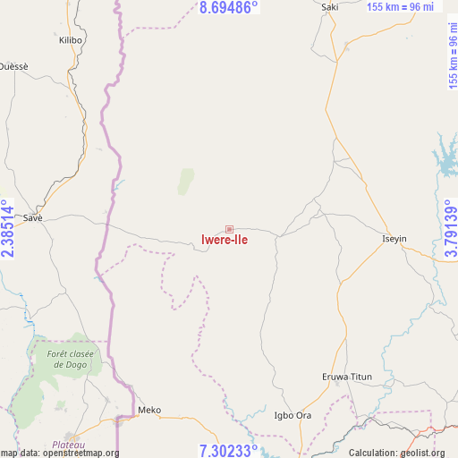
Iwere-Ile GPS coordinates[2]
7° 59' 57.084" North, 3° 5' 17.772" East
| Map corner | latitude | longitude |
|---|---|---|
| Upper-left | 8.69486°, | 2.38514° |
| Center: | 7.99919°, | 3.08827° |
| Lower-right: | 7.30233°, | 3.79139° |
| Map W x H: | 154.8×154.8 km | = 96.2×96.2mi |
| max Lat: | 13.7543° ⇑52.9% North |
| Iwere-Ile: | 7.99919° |
| min Lat: | ⇓47.1% South 4.31231° |
| min Long | Iwere-Ile | max Long |
| 2.73333° | 3.08827° | 14.46552° |
| W 0.8%⇐ | ⇒99.2% E |
Elevation
Elevation of Iwere-Ile is 206 m = 676 ft, and this is 90.5 m = 297 ft below average elevation for this country.
| Max E: |
1599 m = 5246 ft | 60% |
| Avg. | 296.5 m = 973 ft | |
| Iwere-Ile | 206 m = 676 ft | |
Min E: |
2 m = 7 ft | 40% |
See also: Nigeria elevation on elevation.city.
Geographical zone
Iwere-Ile is located in North Torrid zone (between Equator and Tropic of Cancer). Distance of Equator is 889.4 km =552.6 mi to South.| Distance of | km | miles | from Iwere-Ile |
|---|---|---|---|
| North Pole | 9117.6 | 5665.4 | to North |
| Arctic Circle | 6511.7 | 4046.2 | to North |
| Tropic Cancer | 1716.5 | 1066.6 | to North |
| Equator | 889.4 | 552.6 | to South |


Nearby cities:
15 places around Iwere-Ile: (largest is in red/bold)
• Ago Are
66.4 km =41.3 mi,  32°
32°
• Ago-Amodu
90.3 km =56.1 mi,  39°
39°
• Ayete
52.9 km =32.9 mi,  163°
163°
• Ayetoro
84.4 km =52.4 mi,  184°
184°
• Eruwa
63.2 km =39.3 mi,  144°
144°
• Ido
94.3 km =58.6 mi,  128°
128°
• Igbo-Ora
66.6 km =41.4 mi, 160°
• Imeko
66.9 km =41.6 mi,  203°
203°
• Iseyin
56 km =34.8 mi,  93°
93°
• Okeho
28.8 km =17.9 mi,  82°
82°
• Orita Eruwa
62.8 km =39 mi, 142°
• Otu
42 km =26.1 mi,  56°
56°
• Oyo
94.3 km =58.6 mi,  99°
99°
• Saki
81.6 km =50.7 mi,  24°
24°
• Tede
73.4 km =45.6 mi, 32°
Sources, notices
• [Note1] Compared only with cities in Nigeria existing in our database
• [Src1] Map data: © OpenStreetMap contributors (CC-BY-SA)
• [Src2] Other city data from geonames.org with taken over terms of usage.
• [Src3] Geographical zone / Annual Mean Temperature by Robert A. Rohde @ Wikipedia
