Obolo-Eke (1) geodata
Obolo-Eke (1) (Enugu) is a populated place; located in Nigeria in Africa/Lagos (GMT+1) time zone. With population of 5,842 people, there are 446 cities with bigger population in this country. Compared to other cities in Nigeria, 70.1% of cities are located further ↑North; 56.1% of cities are located further ←West and 54.4% of cities have higher elevation than Obolo-Eke (1). Note1


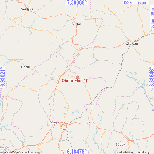
Obolo-Eke (1) GPS coordinates[2]
6° 52' 59.988" North, 7° 37' 59.988" East
| Map corner | latitude | longitude |
|---|---|---|
| Upper-left | 7.58086°, | 6.93021° |
| Center: | 6.88333°, | 7.63333° |
| Lower-right: | 6.18478°, | 8.33646° |
| Map W x H: | 155.2×155.2 km | = 96.4×96.4mi |
| max Lat: | 13.7543° ⇑70.1% North |
| Obolo-Eke (1): | 6.88333° |
| min Lat: | ⇓29.9% South 4.31231° |
| min Long | Obolo-Eke (1) | max Long |
| 2.73333° | 7.63333° | 14.46552° |
| W 56.1%⇐ | ⇒43.9% E |
Elevation
Elevation of Obolo-Eke (1) is 251 m = 823 ft, and this is 45.5 m = 149 ft below average elevation for this country.
| Max E: |
1599 m = 5246 ft | 54.4% |
| Avg. | 296.5 m = 973 ft | |
| Obolo-Eke (1) | 251 m = 823 ft | |
Min E: |
2 m = 7 ft | 45.6% |
See also: Nigeria elevation on elevation.city.
Geographical zone
Obolo-Eke (1) is located in North Torrid zone (between Equator and Tropic of Cancer). Distance of Equator is 765.4 km =475.6 mi to South.| Distance of | km | miles | from Obolo-Eke (1) |
|---|---|---|---|
| North Pole | 9241.7 | 5742.5 | to North |
| Arctic Circle | 6635.8 | 4123.3 | to North |
| Tropic Cancer | 1840.6 | 1143.7 | to North |
| Equator | 765.4 | 475.6 | to South |


Nearby cities:
15 places around Obolo-Eke (1): (largest is in red/bold)
• Aku
39.8 km =24.7 mi,  240°
240°
• Eha Amufu
28.6 km =17.8 mi,  150°
150°
• Enugu-Ezike
22.5 km =14 mi,  299°
299°
• Ete
30.3 km =18.8 mi,  319°
319°
• Ibagwa-Aka
26.2 km =16.3 mi,  278°
278°
• Igumale
38.1 km =23.7 mi,  104°
104°
• Ikem
14.6 km =9.1 mi,  141°
141°
• Nkwo Nike
43.8 km =27.2 mi,  198°
198°
• Nsukka
26.4 km =16.4 mi,  263°
263°
• Obollo-Afor
13.2 km =8.2 mi,  286°
286°
• Ogbede
36.9 km =22.9 mi,  230°
230°
• Okpo
37.9 km =23.5 mi,  347°
347°
• Okpoga
26.3 km =16.3 mi,  48°
48°
• Opi
24.8 km =15.4 mi, 243°
• Otukpa
24.4 km =15.2 mi,  6°
6°
Sources, notices
• [Note1] Compared only with cities in Nigeria existing in our database
• [Src1] Map data: © OpenStreetMap contributors (CC-BY-SA)
• [Src2] Other city data from geonames.org with taken over terms of usage.
• [Src3] Geographical zone / Annual Mean Temperature by Robert A. Rohde @ Wikipedia
