Eha Amufu geodata
Eha Amufu (Enugu) is a populated place; located in Nigeria in Africa/Lagos (GMT+1) time zone. With population of 70,779 people, there are 133 cities with bigger population in this country. Compared to other cities in Nigeria, 73.4% of cities are located further ↑North; 59.1% of cities are located further ←West and 76.6% of cities have higher elevation than Eha Amufu. Note1


Eha Amufu GPS coordinates[2]
6° 39' 32.94" North, 7° 45' 34.596" East
| Map corner | latitude | longitude |
|---|---|---|
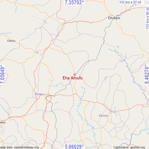
| Upper-left | 7.35702°, | 7.05649° |
| Center: | 6.65915°, | 7.75961° |
| Lower-right: | 5.96029°, | 8.46274° |
| Map W x H: | 155.3×155.3 km | = 96.5×96.5mi |
| max Lat: | 13.7543° ⇑73.4% North |
| Eha Amufu: | 6.65915° |
| min Lat: | ⇓26.6% South 4.31231° |
| min Long | Eha Amufu | max Long |
| 2.73333° | 7.75961° | 14.46552° |
| W 59.1%⇐ | ⇒40.9% E |
Elevation
Elevation of Eha Amufu is 109 m = 358 ft, and this is 187.5 m = 615 ft below average elevation for this country.
| Max E: |
1599 m = 5246 ft | 76.6% |
| Avg. | 296.5 m = 973 ft | |
| Eha Amufu | 109 m = 358 ft | |
Min E: |
2 m = 7 ft | 23.4% |
See also: Eha Amufu elevation on elevation.city.
Geographical zone
Eha Amufu is located in North Torrid zone (between Equator and Tropic of Cancer). Distance of Equator is 740.4 km =460.1 mi to South.| Distance of | km | miles | from Eha Amufu |
|---|---|---|---|
| North Pole | 9266.6 | 5758 | to North |
| Arctic Circle | 6660.7 | 4138.8 | to North |
| Tropic Cancer | 1865.5 | 1159.2 | to North |
| Equator | 740.4 | 460.1 | to South |


Nearby cities:
15 places around Eha Amufu: (largest is in red/bold)
• Amagunze
38.4 km =23.9 mi,  197°
197°
• Effium
33.1 km =20.6 mi,  95°
95°
• Enugu
37.6 km =23.4 mi,  229°
229°
• Ezillo
26.4 km =16.4 mi,  165°
165°
• Ezza-Ohu
43.3 km =26.9 mi,  124°
124°
• Ezzamgbo
36.5 km =22.7 mi,  142°
142°
• Igumale
27.7 km =17.2 mi,  56°
56°
• Ikem
14.3 km =8.9 mi,  339°
339°
• Isieke
43.5 km =27 mi, 135°
• Nkwo Nike
32.2 km =20 mi,  238°
238°
• Obollo-Afor
39.1 km =24.3 mi,  317°
317°
• Obolo-Eke (1)
28.6 km =17.8 mi,  330°
330°
• Ogbede
42.6 km =26.5 mi,  272°
272°
• Okpoga
42.6 km =26.5 mi,  7°
7°
• Opi
38.6 km =24 mi,  290°
290°
Sources, notices
• [Note1] Compared only with cities in Nigeria existing in our database
• [Src1] Map data: © OpenStreetMap contributors (CC-BY-SA)
• [Src2] Other city data from geonames.org with taken over terms of usage.
• [Src3] Geographical zone / Annual Mean Temperature by Robert A. Rohde @ Wikipedia
