Otukpa geodata
Otukpa (Benue) is a seat of a second-order administrative division; located in Nigeria in Africa/Lagos (GMT+1) time zone. With population of 21,686 people, there are 190 cities with bigger population in this country. Compared to other cities in Nigeria, 67.5% of cities are located further ↑North; 56.8% of cities are located further ←West and 72.8% of cities have lower elevation than Otukpa. Note1


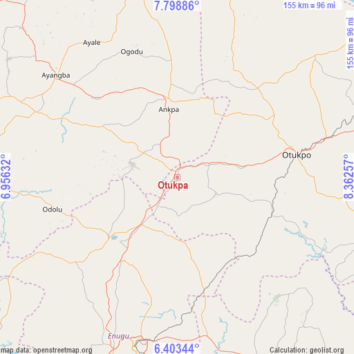
Otukpa GPS coordinates[2]
7° 6' 6.048" North, 7° 39' 34.02" East
| Map corner | latitude | longitude |
|---|---|---|
| Upper-left | 7.79886°, | 6.95632° |
| Center: | 7.10168°, | 7.65945° |
| Lower-right: | 6.40344°, | 8.36257° |
| Map W x H: | 155.2×155.2 km | = 96.4×96.4mi |
| max Lat: | 13.7543° ⇑67.5% North |
| Otukpa: | 7.10168° |
| min Lat: | ⇓32.5% South 4.31231° |
| min Long | Otukpa | max Long |
| 2.73333° | 7.65945° | 14.46552° |
| W 56.8%⇐ | ⇒43.2% E |
Elevation
Elevation of Otukpa is 417 m = 1368 ft, and this is 120.5 m = 395 ft above average elevation for this country.
| Max E: |
1599 m = 5246 ft | 27.2% |
| Otukpa | 417 m 1368 ft | |
| Avg. | 296.5 m = 973 ft | |
Min E: |
2 m = 7 ft | 72.8% |
See also: Nigeria elevation on elevation.city.
Geographical zone
Otukpa is located in North Torrid zone (between Equator and Tropic of Cancer). Distance of Equator is 789.6 km =490.6 mi to South.| Distance of | km | miles | from Otukpa |
|---|---|---|---|
| North Pole | 9217.4 | 5727.4 | to North |
| Arctic Circle | 6611.5 | 4108.2 | to North |
| Tropic Cancer | 1816.3 | 1128.6 | to North |
| Equator | 789.6 | 490.6 | to South |


Nearby cities:
15 places around Otukpa: (largest is in red/bold)
• Ankpa
33.6 km =20.9 mi,  354°
354°
• Boju
38.2 km =23.7 mi,  42°
42°
• Eha Amufu
50.4 km =31.3 mi,  167°
167°
• Enugu-Ezike
26.1 km =16.2 mi,  239°
239°
• Ete
22.8 km =14.2 mi,  266°
266°
• Ibagwa-Aka
35.2 km =21.9 mi,  234°
234°
• Igumale
48 km =29.8 mi,  134°
134°
• Ikem
36.3 km =22.6 mi, 170°
• Nsukka
39.8 km =24.7 mi, 227°
• Obollo-Afor
25.8 km =16 mi,  217°
217°
• Obolo-Eke (1)
24.4 km =15.2 mi,  186°
186°
• Ochobo
36.7 km =22.8 mi,  76°
76°
• Okpo
16.8 km =10.4 mi,  319°
319°
• Okpoga
18.2 km =11.3 mi,  112°
112°
• Opi
43.4 km =27 mi, 215°
Sources, notices
• [Note1] Compared only with cities in Nigeria existing in our database
• [Src1] Map data: © OpenStreetMap contributors (CC-BY-SA)
• [Src2] Other city data from geonames.org with taken over terms of usage.
• [Src3] Geographical zone / Annual Mean Temperature by Robert A. Rohde @ Wikipedia
