Igumale geodata
Igumale (Benue) is a seat of a second-order administrative division; located in Nigeria in Africa/Lagos (GMT+1) time zone. In our database, there are 451 cities with bigger population. Compared to other cities in Nigeria, 71% of cities are located further ↑North; 63.1% of cities are located further ←West and 80.2% of cities have higher elevation than Igumale. Note1


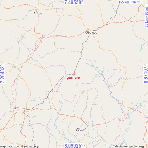
Igumale GPS coordinates[2]
6° 47' 52.512" North, 7° 58' 4.584" East
| Map corner | latitude | longitude |
|---|---|---|
| Upper-left | 7.49558°, | 7.26482° |
| Center: | 6.79792°, | 7.96794° |
| Lower-right: | 6.09925°, | 8.67107° |
| Map W x H: | 155.3×155.3 km | = 96.5×96.5mi |
| max Lat: | 13.7543° ⇑71% North |
| Igumale: | 6.79792° |
| min Lat: | ⇓29% South 4.31231° |
| min Long | Igumale | max Long |
| 2.73333° | 7.96794° | 14.46552° |
| W 63.1%⇐ | ⇒36.9% E |
Elevation
Elevation of Igumale is 81 m = 266 ft, and this is 215.5 m = 707 ft below average elevation for this country.
| Max E: |
1599 m = 5246 ft | 80.2% |
| Avg. | 296.5 m = 973 ft | |
| Igumale | 81 m = 266 ft | |
Min E: |
2 m = 7 ft | 19.8% |
See also: Nigeria elevation on elevation.city.
Geographical zone
Igumale is located in North Torrid zone (between Equator and Tropic of Cancer). Distance of Equator is 755.9 km =469.7 mi to South.| Distance of | km | miles | from Igumale |
|---|---|---|---|
| North Pole | 9251.2 | 5748.4 | to North |
| Arctic Circle | 6645.3 | 4129.2 | to North |
| Tropic Cancer | 1850.1 | 1149.6 | to North |
| Equator | 755.9 | 469.7 | to South |


Nearby cities:
15 places around Igumale: (largest is in red/bold)
• Effium
21.1 km =13.1 mi,  151°
151°
• Eha Amufu
27.7 km =17.2 mi,  236°
236°
• Ezillo
44.2 km =27.5 mi,  202°
202°
• Ezza-Ohu
41.7 km =25.9 mi,  162°
162°
• Ezzamgbo
44.4 km =27.6 mi,  180°
180°
• Ikem
28 km =17.4 mi,  265°
265°
• Isieke
46.9 km =29.1 mi,  170°
170°
• Obarike-Ito
46.6 km =29 mi,  57°
57°
• Obollo-Afor
51.3 km =31.9 mi,  284°
284°
• Obolo-Eke (1)
38.1 km =23.7 mi, 284°
• Ochobo
42.6 km =26.5 mi,  2°
2°
• Oju
50.1 km =31.1 mi,  83°
83°
• Okpoga
31.9 km =19.8 mi,  327°
327°
• Otukpa
48 km =29.8 mi,  314°
314°
• Ugbodo
36.5 km =22.7 mi, 150°
Sources, notices
• [Note1] Compared only with cities in Nigeria existing in our database
• [Src1] Map data: © OpenStreetMap contributors (CC-BY-SA)
• [Src2] Other city data from geonames.org with taken over terms of usage.
• [Src3] Geographical zone / Annual Mean Temperature by Robert A. Rohde @ Wikipedia
