Mallammaduri geodata
Mallammaduri (Jigawa) is a populated place; located in Nigeria in Africa/Lagos (GMT+1) time zone. With population of 11,156 people, there are 317 cities with bigger population in this country. Compared to other cities in Nigeria, 91.4% of cities are located further ↓South; 84.2% of cities are located further ←West and 62.4% of cities have lower elevation than Mallammaduri. Note1


Mallammaduri GPS coordinates[2]
12° 33' 51.372" North, 9° 57' 26.172" East
| Map corner | latitude | longitude |
|---|---|---|
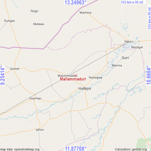
| Upper-left | 13.24963°, | 9.25414° |
| Center: | 12.56427°, | 9.95727° |
| Lower-right: | 11.87708°, | 10.6604° |
| Map W x H: | 152.6×152.6 km | = 94.8×94.8mi |
| max Lat: | 13.7543° ⇑8.6% North |
| Mallammaduri: | 12.56427° |
| min Lat: | ⇓91.4% South 4.31231° |
| min Long | Mallammaduri | max Long |
| 2.73333° | 9.95727° | 14.46552° |
| W 84.2%⇐ | ⇒15.8% E |
Elevation
Elevation of Mallammaduri is 357 m = 1171 ft, and this is 60.5 m = 198 ft above average elevation for this country.
| Max E: |
1599 m = 5246 ft | 37.6% |
| Mallammaduri | 357 m 1171 ft | |
| Avg. | 296.5 m = 973 ft | |
Min E: |
2 m = 7 ft | 62.4% |
See also: Nigeria elevation on elevation.city.
Geographical zone
Mallammaduri is located in North Torrid zone (between Equator and Tropic of Cancer). Distance of this Northern Tropic circle is 1208.9 km =751.2 mi to North.| Distance of | km | miles | from Mallammaduri |
|---|---|---|---|
| North Pole | 8610 | 5350 | to North |
| Arctic Circle | 6004.2 | 3730.8 | to North |
| Tropic Cancer | 1208.9 | 751.2 | to North |
| Equator | 1397 | 868.1 | to South |


Nearby cities:
15 places around Mallammaduri: (largest is in red/bold)
• Auyo
25.7 km =16 mi,  184°
184°
• Birniwa
39.4 km =24.5 mi,  50°
50°
• Gagarawa
49.6 km =30.8 mi,  249°
249°
• Gumel
62.2 km =38.6 mi,  276°
276°
• Guri
53.4 km =33.2 mi,  70°
70°
• Hadejia
15.3 km =9.5 mi,  143°
143°
• Kafin Hausa
36.5 km =22.7 mi,  187°
187°
• Katagum
52.8 km =32.8 mi,  126°
126°
• Kaugama
25.9 km =16.1 mi, 247°
• Kiri Kasamma
35.3 km =21.9 mi, 66°
• Machina
64.4 km =40 mi,  8°
8°
• Maigatari
61.8 km =38.4 mi,  295°
295°
• Malam Madori
8.3 km =5.2 mi,  270°
270°
• Miga
44.8 km =27.8 mi,  216°
216°
• Nguru
64.2 km =39.9 mi,  57°
57°
Sources, notices
• [Note1] Compared only with cities in Nigeria existing in our database
• [Src1] Map data: © OpenStreetMap contributors (CC-BY-SA)
• [Src2] Other city data from geonames.org with taken over terms of usage.
• [Src3] Geographical zone / Annual Mean Temperature by Robert A. Rohde @ Wikipedia
