Hadejia geodata
Hadejia (Jigawa) is a seat of a second-order administrative division; located in Nigeria in Africa/Lagos (GMT+1) time zone. With population of 110,753 people, there are 78 cities with bigger population in this country. Compared to other cities in Nigeria, 89.9% of cities are located further ↓South; 84.8% of cities are located further ←West and 62.9% of cities have lower elevation than Hadejia. Note1


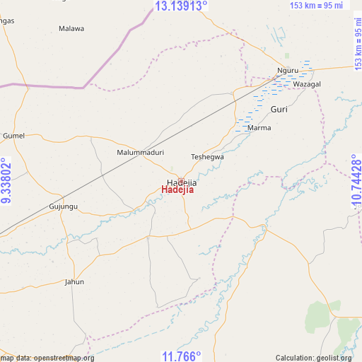
Hadejia GPS coordinates[2]
12° 27' 12.492" North, 10° 2' 28.14" East
| Map corner | latitude | longitude |
|---|---|---|
| Upper-left | 13.13913°, | 9.33802° |
| Center: | 12.45347°, | 10.04115° |
| Lower-right: | 11.766°, | 10.74428° |
| Map W x H: | 152.7×152.7 km | = 94.9×94.9mi |
| max Lat: | 13.7543° ⇑10.1% North |
| Hadejia: | 12.45347° |
| min Lat: | ⇓89.9% South 4.31231° |
| min Long | Hadejia | max Long |
| 2.73333° | 10.04115° | 14.46552° |
| W 84.8%⇐ | ⇒15.2% E |
Elevation
Elevation of Hadejia is 359 m = 1178 ft, and this is 62.5 m = 205 ft above average elevation for this country.
| Max E: |
1599 m = 5246 ft | 37.1% |
| Hadejia | 359 m 1178 ft | |
| Avg. | 296.5 m = 973 ft | |
Min E: |
2 m = 7 ft | 62.9% |
See also: Hadejia elevation on elevation.city.
Geographical zone
Hadejia is located in North Torrid zone (between Equator and Tropic of Cancer). Distance of this Northern Tropic circle is 1221.2 km =758.8 mi to North.| Distance of | km | miles | from Hadejia |
|---|---|---|---|
| North Pole | 8622.4 | 5357.7 | to North |
| Arctic Circle | 6016.5 | 3738.5 | to North |
| Tropic Cancer | 1221.2 | 758.8 | to North |
| Equator | 1384.7 | 860.4 | to South |


Nearby cities:
15 places around Hadejia: (largest is in red/bold)
• Auyo
17.4 km =10.8 mi,  219°
219°
• Birniwa
43.1 km =26.8 mi,  29°
29°
• Gagarawa
55.9 km =34.7 mi,  264°
264°
• Gamawa
64.6 km =40.1 mi,  123°
123°
• Guri
51.2 km =31.8 mi,  53°
53°
• Itas
66.8 km =41.5 mi,  187°
187°
• Jahun
61.5 km =38.2 mi,  226°
226°
• Kafin Hausa
27.7 km =17.2 mi,  210°
210°
• Katagum
38.4 km =23.9 mi, 119°
• Kaugama
33.1 km =20.6 mi,  274°
274°
• Kiri Kasamma
35.3 km =21.9 mi,  41°
41°
• Malam Madori
21.4 km =13.3 mi,  305°
305°
• Mallammaduri
15.3 km =9.5 mi,  323°
323°
• Miga
42.8 km =26.6 mi,  236°
236°
• Nguru
65.1 km =40.5 mi, 43°
Sources, notices
• [Note1] Compared only with cities in Nigeria existing in our database
• [Src1] Map data: © OpenStreetMap contributors (CC-BY-SA)
• [Src2] Other city data from geonames.org with taken over terms of usage.
• [Src3] Geographical zone / Annual Mean Temperature by Robert A. Rohde @ Wikipedia
