Magumeri geodata
Magumeri (Borno) is a seat of a second-order administrative division; located in Nigeria in Africa/Lagos (GMT+1) time zone. With population of 19,363 people, there are 204 cities with bigger population in this country. Compared to other cities in Nigeria, 85.5% of cities are located further ↓South; 96.9% of cities are located further ←West and 58.5% of cities have lower elevation than Magumeri. Note1


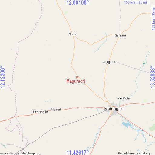
Magumeri GPS coordinates[2]
12° 6' 52.236" North, 12° 49' 34.32" East
| Map corner | latitude | longitude |
|---|---|---|
| Upper-left | 12.80108°, | 12.12308° |
| Center: | 12.11451°, | 12.8262° |
| Lower-right: | 11.42617°, | 13.52933° |
| Map W x H: | 152.9×152.9 km | = 95×95mi |
| max Lat: | 13.7543° ⇑14.5% North |
| Magumeri: | 12.11451° |
| min Lat: | ⇓85.5% South 4.31231° |
| min Long | Magumeri | max Long |
| 2.73333° | 12.8262° | 14.46552° |
| W 96.9%⇐ | ⇒3.1% E |
Elevation
Elevation of Magumeri is 336 m = 1102 ft, and this is 39.5 m = 130 ft above average elevation for this country.
| Max E: |
1599 m = 5246 ft | 41.5% |
| Magumeri | 336 m 1102 ft | |
| Avg. | 296.5 m = 973 ft | |
Min E: |
2 m = 7 ft | 58.5% |
See also: Nigeria elevation on elevation.city.
Geographical zone
Magumeri is located in North Torrid zone (between Equator and Tropic of Cancer). Distance of this Northern Tropic circle is 1258.9 km =782.2 mi to North.| Distance of | km | miles | from Magumeri |
|---|---|---|---|
| North Pole | 8660.1 | 5381.1 | to North |
| Arctic Circle | 6054.2 | 3761.9 | to North |
| Tropic Cancer | 1258.9 | 782.2 | to North |
| Equator | 1347 | 837 | to South |


Nearby cities:
15 places around Magumeri: (largest is in red/bold)
• Benisheikh
49.8 km =30.9 mi,  227°
227°
• Bornu Yassu
33.2 km =20.6 mi,  302°
302°
• Damaturu
102.6 km =63.8 mi,  246°
246°
• Damboa
106.9 km =66.4 mi,  184°
184°
• Dankalwa
80.9 km =50.3 mi,  239°
239°
• Gajiram
59.3 km =36.8 mi,  44°
44°
• Goniri
89.6 km =55.7 mi,  218°
218°
• Gubio
42.9 km =26.7 mi,  353°
353°
• Gudumbali
99.7 km =62 mi,  22°
22°
• Khaddamari
48.7 km =30.3 mi,  115°
115°
• Konduga
82.3 km =51.1 mi,  128°
128°
• Mafa
86.8 km =53.9 mi,  104°
104°
• Maiduguri
46.7 km =29 mi, 129°
• Monguno
105.4 km =65.5 mi,  54°
54°
• Yajiwa
81.8 km =50.8 mi,  188°
188°
Sources, notices
• [Note1] Compared only with cities in Nigeria existing in our database
• [Src1] Map data: © OpenStreetMap contributors (CC-BY-SA)
• [Src2] Other city data from geonames.org with taken over terms of usage.
• [Src3] Geographical zone / Annual Mean Temperature by Robert A. Rohde @ Wikipedia
