Igbokoda geodata
Igbokoda (Ondo) is a seat of a second-order administrative division; located in Nigeria in Africa/Lagos (GMT+1) time zone. In our database, there are 451 cities with bigger population. Compared to other cities in Nigeria, 79.2% of cities are located further ↑North; 84.1% of cities are located further →East and 98.5% of cities have higher elevation than Igbokoda. Note1


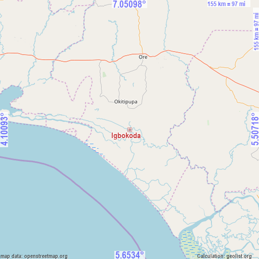
Igbokoda GPS coordinates[2]
6° 21' 9.576" North, 4° 48' 14.616" East
| Map corner | latitude | longitude |
|---|---|---|
| Upper-left | 7.05098°, | 4.10093° |
| Center: | 6.35266°, | 4.80406° |
| Lower-right: | 5.6534°, | 5.50718° |
| Map W x H: | 155.4×155.4 km | = 96.6×96.6mi |
| max Lat: | 13.7543° ⇑79.2% North |
| Igbokoda: | 6.35266° |
| min Lat: | ⇓20.8% South 4.31231° |
| min Long | Igbokoda | max Long |
| 2.73333° | 4.80406° | 14.46552° |
| W 15.9%⇐ | ⇒84.1% E |
Elevation
Elevation of Igbokoda is 7 m = 23 ft, and this is 289.5 m = 950 ft below average elevation for this country.
| Max E: |
1599 m = 5246 ft | 98.5% |
| Avg. | 296.5 m = 973 ft | |
| Igbokoda | 7 m = 23 ft | |
Min E: |
2 m = 7 ft | 1.5% |
See also: Nigeria elevation on elevation.city.
Geographical zone
Igbokoda is located in North Torrid zone (between Equator and Tropic of Cancer). Distance of Equator is 706.3 km =438.9 mi to South.| Distance of | km | miles | from Igbokoda |
|---|---|---|---|
| North Pole | 9300.7 | 5779.2 | to North |
| Arctic Circle | 6694.8 | 4160 | to North |
| Tropic Cancer | 1899.6 | 1180.4 | to North |
| Equator | 706.3 | 438.9 | to South |


Nearby cities:
15 places around Igbokoda: (largest is in red/bold)
• Abigi
47.6 km =29.6 mi,  288°
288°
• Agbabu
26.4 km =16.4 mi,  7°
7°
• Benin City
90.8 km =56.4 mi,  91°
91°
• Bolorunduro
92.1 km =57.2 mi, 11°
• Idanre
91.3 km =56.7 mi,  22°
22°
• Igbekebo
6.4 km =4 mi, 87°
• Iguobazuwa
65.3 km =40.6 mi,  68°
68°
• Koko
81.9 km =50.9 mi,  118°
118°
• Ode-Irele
17.4 km =10.8 mi, 24°
• Ogbere
83 km =51.6 mi,  301°
301°
• Okada
77.8 km =48.3 mi,  56°
56°
• Ondo
82.4 km =51.2 mi,  2°
2°
• Ore
44.6 km =27.7 mi, 10°
• Siluko
44.3 km =27.5 mi, 62°
• Uselu
89.1 km =55.4 mi, 87°
Sources, notices
• [Note1] Compared only with cities in Nigeria existing in our database
• [Src1] Map data: © OpenStreetMap contributors (CC-BY-SA)
• [Src2] Other city data from geonames.org with taken over terms of usage.
• [Src3] Geographical zone / Annual Mean Temperature by Robert A. Rohde @ Wikipedia
