Ondo geodata
Ondo is a seat of a second-order administrative division; located in Nigeria in Africa/Lagos (GMT+1) time zone. With population of 257,005 people, there are 33 cities with bigger population in this country. Compared to other cities in Nigeria, 67.6% of cities are located further ↑North; 83.3% of cities are located further →East and 52.9% of cities have higher elevation than Ondo. Note1


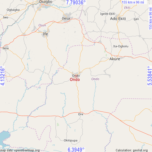
Ondo GPS coordinates[2]
7° 5' 35.376" North, 4° 50' 7.008" East
| Map corner | latitude | longitude |
|---|---|---|
| Upper-left | 7.79036°, | 4.13216° |
| Center: | 7.09316°, | 4.83528° |
| Lower-right: | 6.3949°, | 5.53841° |
| Map W x H: | 155.2×155.2 km | = 96.4×96.4mi |
| max Lat: | 13.7543° ⇑67.6% North |
| Ondo: | 7.09316° |
| min Lat: | ⇓32.4% South 4.31231° |
| min Long | Ondo | max Long |
| 2.73333° | 4.83528° | 14.46552° |
| W 16.7%⇐ | ⇒83.3% E |
Elevation
Elevation of Ondo is 263 m = 863 ft, and this is 33.5 m = 110 ft below average elevation for this country.
| Max E: |
1599 m = 5246 ft | 52.9% |
| Avg. | 296.5 m = 973 ft | |
| Ondo | 263 m = 863 ft | |
Min E: |
2 m = 7 ft | 47.1% |
See also: Ondo elevation on elevation.city.
Geographical zone
Ondo is located in North Torrid zone (between Equator and Tropic of Cancer). Distance of Equator is 788.7 km =490.1 mi to South.| Distance of | km | miles | from Ondo |
|---|---|---|---|
| North Pole | 9218.4 | 5728 | to North |
| Arctic Circle | 6612.5 | 4108.8 | to North |
| Tropic Cancer | 1817.2 | 1129.2 | to North |
| Equator | 788.7 | 490.1 | to South |


Nearby cities:
15 places around Ondo: (largest is in red/bold)
• Agbabu
56.1 km =34.9 mi,  180°
180°
• Akure
43.3 km =26.9 mi,  65°
65°
• Bolorunduro
16.3 km =10.1 mi,  60°
60°
• Idanre
31 km =19.3 mi,  85°
85°
• Ifetedo
18 km =11.2 mi,  304°
304°
• Igbara-Odo
52 km =32.3 mi,  28°
28°
• Igbara-Oke
43.1 km =26.8 mi, 34°
• Iju
57.5 km =35.7 mi,  54°
54°
• Ilare
42 km =26.1 mi, 46°
• Ile-Ife
52.8 km =32.8 mi,  324°
324°
• Ile-Oluji
13.8 km =8.6 mi,  15°
15°
• Iperindo
45.5 km =28.3 mi,  358°
358°
• Ita-Ogbolu
54.7 km =34 mi, 56°
• Ore
38.7 km =24 mi,  173°
173°
• Owena
23.5 km =14.6 mi, 61°
Sources, notices
• [Note1] Compared only with cities in Nigeria existing in our database
• [Src1] Map data: © OpenStreetMap contributors (CC-BY-SA)
• [Src2] Other city data from geonames.org with taken over terms of usage.
• [Src3] Geographical zone / Annual Mean Temperature by Robert A. Rohde @ Wikipedia
