Gamboru geodata
Gamboru (Borno) is a seat of a second-order administrative division; located in Nigeria in Africa/Lagos (GMT+1) time zone. With population of 84,672 people, there are 105 cities with bigger population in this country. Compared to other cities in Nigeria, 89.1% of cities are located further ↓South; 99.9% of cities are located further ←West and 50.9% of cities have lower elevation than Gamboru. Note1


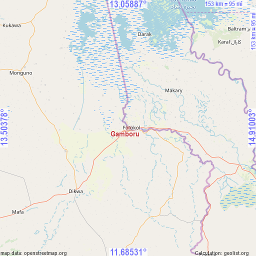
Gamboru GPS coordinates[2]
12° 22' 22.764" North, 14° 12' 24.84" East
| Map corner | latitude | longitude |
|---|---|---|
| Upper-left | 13.05887°, | 13.50378° |
| Center: | 12.37299°, | 14.2069° |
| Lower-right: | 11.68531°, | 14.91003° |
| Map W x H: | 152.7×152.7 km | = 94.9×94.9mi |
| max Lat: | 13.7543° ⇑10.9% North |
| Gamboru: | 12.37299° |
| min Lat: | ⇓89.1% South 4.31231° |
| min Long | Gamboru | max Long |
| 2.73333° | 14.2069° | 14.46552° |
| W 99.9%⇐ | ⇒0.099999999999994% E |
Elevation
Elevation of Gamboru is 291 m = 955 ft, and this is 5.5 m = 18 ft below average elevation for this country.
| Max E: |
1599 m = 5246 ft | 49.1% |
| Avg. | 296.5 m = 973 ft | |
| Gamboru | 291 m = 955 ft | |
Min E: |
2 m = 7 ft | 50.9% |
See also: Gamboru elevation on elevation.city.
Geographical zone
Gamboru is located in North Torrid zone (between Equator and Tropic of Cancer). Distance of this Northern Tropic circle is 1230.2 km =764.4 mi to North.| Distance of | km | miles | from Gamboru |
|---|---|---|---|
| North Pole | 8631.3 | 5363.2 | to North |
| Arctic Circle | 6025.4 | 3744 | to North |
| Tropic Cancer | 1230.2 | 764.4 | to North |
| Equator | 1375.7 | 854.8 | to South |


Nearby cities:
15 places around Gamboru: (largest is in red/bold)
• Bama
110.2 km =68.5 mi,  210°
210°
• Dikwa
48.9 km =30.4 mi,  219°
219°
• Gajiram
108.8 km =67.6 mi,  276°
276°
• Gudumbali
128.3 km =79.7 mi,  299°
299°
• Khaddamari
117.2 km =72.8 mi,  244°
244°
• Konduga
117.3 km =72.9 mi,  226°
226°
• Kukawa
92.7 km =57.6 mi,  311°
311°
• Mafa
82.7 km =51.4 mi, 232°
• Magumeri
152.8 km =94.9 mi,  259°
259°
• Maiduguri
128.2 km =79.7 mi, 242°
• Marte
41 km =25.5 mi,  268°
268°
• Monguno
72.5 km =45 mi, 297°
• Ngala
4.2 km =2.6 mi, 211°
• Rann
30.4 km =18.9 mi,  112°
112°
• Tokombere
150.1 km =93.3 mi, 211°
Sources, notices
• [Note1] Compared only with cities in Nigeria existing in our database
• [Src1] Map data: © OpenStreetMap contributors (CC-BY-SA)
• [Src2] Other city data from geonames.org with taken over terms of usage.
• [Src3] Geographical zone / Annual Mean Temperature by Robert A. Rohde @ Wikipedia
