Bama geodata
Bama (Borno) is a seat of a second-order administrative division; located in Nigeria in Africa/Lagos (GMT+1) time zone. With population of 118,121 people, there are 70 cities with bigger population in this country. Compared to other cities in Nigeria, 77.9% of cities are located further ↓South; 99.3% of cities are located further ←West and 57.7% of cities have lower elevation than Bama. Note1


Bama GPS coordinates[2]
11° 31' 16.824" North, 13° 41' 22.272" East
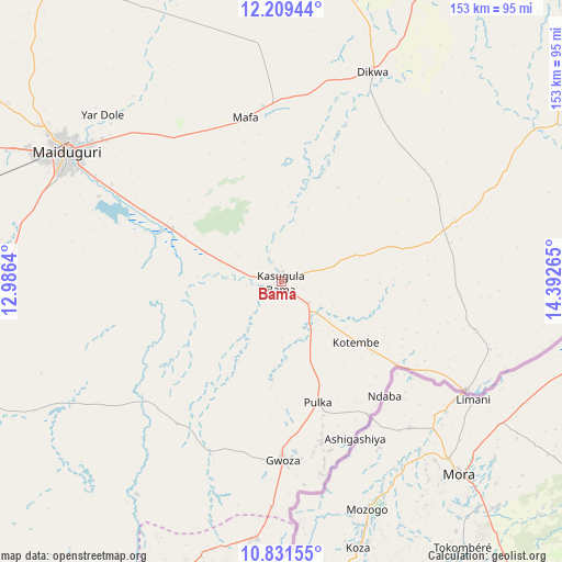
| Map corner | latitude | longitude |
|---|---|---|
| Upper-left | 12.20944°, | 12.9864° |
| Center: | 11.52134°, | 13.68952° |
| Lower-right: | 10.83155°, | 14.39265° |
| Map W x H: | 153.2×153.2 km | = 95.2×95.2mi |
| max Lat: | 13.7543° ⇑22.1% North |
| Bama: | 11.52134° |
| min Lat: | ⇓77.9% South 4.31231° |
| min Long | Bama | max Long |
| 2.73333° | 13.68952° | 14.46552° |
| W 99.3%⇐ | ⇒0.7% E |
Elevation
Elevation of Bama is 330 m = 1083 ft, and this is 33.5 m = 110 ft above average elevation for this country.
| Max E: |
1599 m = 5246 ft | 42.3% |
| Bama | 330 m 1083 ft | |
| Avg. | 296.5 m = 973 ft | |
Min E: |
2 m = 7 ft | 57.7% |
See also: Bama elevation on elevation.city.
Geographical zone
Bama is located in North Torrid zone (between Equator and Tropic of Cancer). Distance of Equator is 1281.1 km =796 mi to South.| Distance of | km | miles | from Bama |
|---|---|---|---|
| North Pole | 8726 | 5422.1 | to North |
| Arctic Circle | 6120.1 | 3802.9 | to North |
| Tropic Cancer | 1324.9 | 823.3 | to North |
| Equator | 1281.1 | 796 | to South |


Nearby cities:
15 places around Bama: (largest is in red/bold)
• Damboa
109.6 km =68.1 mi,  248°
248°
• Dikwa
62.4 km =38.8 mi,  23°
23°
• Gamboru
110.2 km =68.5 mi,  30°
30°
• Gulak
83.5 km =51.9 mi,  197°
197°
• Gwoza
48.7 km =30.3 mi,  179°
179°
• Khaddamari
67.2 km =41.8 mi,  311°
311°
• Konduga
33 km =20.5 mi,  296°
296°
• Madagali
70.6 km =43.9 mi,  185°
185°
• Mafa
45.8 km =28.5 mi,  347°
347°
• Maiduguri
68.3 km =42.4 mi, 301°
• Marte
95.1 km =59.1 mi,  9°
9°
• Michika
105.4 km =65.5 mi, 198°
• Ngala
105.9 km =65.8 mi, 30°
• Tokombere
39.9 km =24.8 mi,  213°
213°
• Yajiwa
106.7 km =66.3 mi,  261°
261°
Sources, notices
• [Note1] Compared only with cities in Nigeria existing in our database
• [Src1] Map data: © OpenStreetMap contributors (CC-BY-SA)
• [Src2] Other city data from geonames.org with taken over terms of usage.
• [Src3] Geographical zone / Annual Mean Temperature by Robert A. Rohde @ Wikipedia
