Adani geodata
Adani (Enugu) is a populated place; located in Nigeria in Africa/Lagos (GMT+1) time zone. With population of 6,161 people, there are 437 cities with bigger population in this country. Compared to other cities in Nigeria, 72% of cities are located further ↑North; 56.7% of cities are located further →East and 84.3% of cities have higher elevation than Adani. Note1


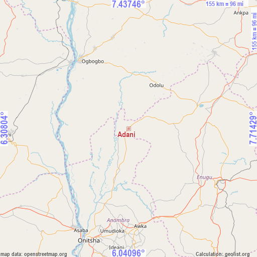
Adani GPS coordinates[2]
6° 44' 22.956" North, 7° 0' 40.212" East
| Map corner | latitude | longitude |
|---|---|---|
| Upper-left | 7.43746°, | 6.30804° |
| Center: | 6.73971°, | 7.01117° |
| Lower-right: | 6.04096°, | 7.71429° |
| Map W x H: | 155.3×155.3 km | = 96.5×96.5mi |
| max Lat: | 13.7543° ⇑72% North |
| Adani: | 6.73971° |
| min Lat: | ⇓28% South 4.31231° |
| min Long | Adani | max Long |
| 2.73333° | 7.01117° | 14.46552° |
| W 43.3%⇐ | ⇒56.7% E |
Elevation
Elevation of Adani is 59 m = 194 ft, and this is 237.5 m = 779 ft below average elevation for this country.
| Max E: |
1599 m = 5246 ft | 84.3% |
| Avg. | 296.5 m = 973 ft | |
| Adani | 59 m = 194 ft | |
Min E: |
2 m = 7 ft | 15.7% |
See also: Nigeria elevation on elevation.city.
Geographical zone
Adani is located in North Torrid zone (between Equator and Tropic of Cancer). Distance of Equator is 749.4 km =465.7 mi to South.| Distance of | km | miles | from Adani |
|---|---|---|---|
| North Pole | 9257.7 | 5752.5 | to North |
| Arctic Circle | 6651.8 | 4133.2 | to North |
| Tropic Cancer | 1856.5 | 1153.6 | to North |
| Equator | 749.4 | 465.7 | to South |


Nearby cities:
15 places around Adani: (largest is in red/bold)
• Achalla
45.1 km =28 mi,  183°
183°
• Adoru
31.2 km =19.4 mi,  32°
32°
• Aguobu-Owa
50 km =31.1 mi,  144°
144°
• Aku
34.1 km =21.2 mi,  95°
95°
• Anaku
31.5 km =19.6 mi,  196°
196°
• Ibagwa-Aka
47.2 km =29.3 mi,  65°
65°
• Illushi
42.9 km =26.7 mi,  259°
259°
• Nsukka
44.4 km =27.6 mi, 72°
• Nzam
44.6 km =27.7 mi,  224°
224°
• Ogbede
40.8 km =25.4 mi, 100°
• Ogurugu
8.5 km =5.3 mi,  307°
307°
• Onyedega
40.3 km =25 mi,  293°
293°
• Opi
46.8 km =29.1 mi,  84°
84°
• Otuocha
48.1 km =29.9 mi, 202°
• Umulona
27.5 km =17.1 mi,  159°
159°
Sources, notices
• [Note1] Compared only with cities in Nigeria existing in our database
• [Src1] Map data: © OpenStreetMap contributors (CC-BY-SA)
• [Src2] Other city data from geonames.org with taken over terms of usage.
• [Src3] Geographical zone / Annual Mean Temperature by Robert A. Rohde @ Wikipedia
