Illushi geodata
Illushi (Edo) is a populated place; located in Nigeria in Africa/Lagos (GMT+1) time zone. With population of 7,340 people, there are 406 cities with bigger population in this country. Compared to other cities in Nigeria, 73.1% of cities are located further ↑North; 63.3% of cities are located further →East and 89.8% of cities have higher elevation than Illushi. Note1


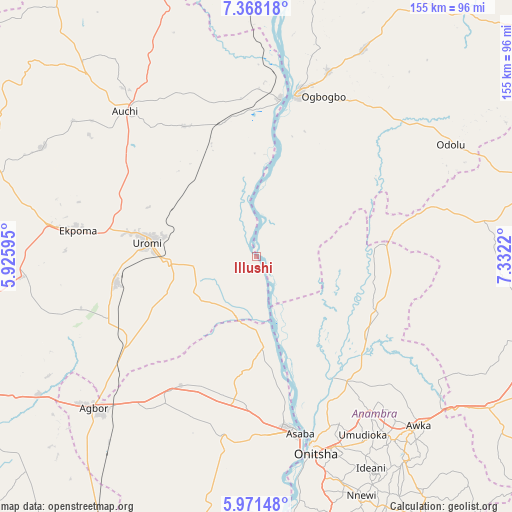
Illushi GPS coordinates[2]
6° 40' 13.188" North, 6° 37' 44.652" East
| Map corner | latitude | longitude |
|---|---|---|
| Upper-left | 7.36818°, | 5.92595° |
| Center: | 6.67033°, | 6.62907° |
| Lower-right: | 5.97148°, | 7.3322° |
| Map W x H: | 155.3×155.3 km | = 96.5×96.5mi |
| max Lat: | 13.7543° ⇑73.1% North |
| Illushi: | 6.67033° |
| min Lat: | ⇓26.9% South 4.31231° |
| min Long | Illushi | max Long |
| 2.73333° | 6.62907° | 14.46552° |
| W 36.7%⇐ | ⇒63.3% E |
Elevation
Elevation of Illushi is 32 m = 105 ft, and this is 264.5 m = 868 ft below average elevation for this country.
| Max E: |
1599 m = 5246 ft | 89.8% |
| Avg. | 296.5 m = 973 ft | |
| Illushi | 32 m = 105 ft | |
Min E: |
2 m = 7 ft | 10.2% |
See also: Nigeria elevation on elevation.city.
Geographical zone
Illushi is located in North Torrid zone (between Equator and Tropic of Cancer). Distance of Equator is 741.7 km =460.9 mi to South.| Distance of | km | miles | from Illushi |
|---|---|---|---|
| North Pole | 9265.4 | 5757.3 | to North |
| Arctic Circle | 6659.5 | 4138 | to North |
| Tropic Cancer | 1864.2 | 1158.4 | to North |
| Equator | 741.7 | 460.9 | to South |


Nearby cities:
15 places around Illushi: (largest is in red/bold)
• Adani
42.9 km =26.7 mi,  79°
79°
• Agenebode
48.9 km =30.4 mi,  8°
8°
• Akwukwu-Igbo
35 km =21.7 mi,  186°
186°
• Anaku
40 km =24.9 mi,  124°
124°
• Fugar
48.9 km =30.4 mi,  342°
342°
• Idah
50.7 km =31.5 mi, 13°
• Igueben
43.3 km =26.9 mi,  259°
259°
• Irrua
45.8 km =28.5 mi,  279°
279°
• Issele-Uku
42.9 km =26.7 mi,  203°
203°
• Nzam
26.6 km =16.5 mi,  155°
155°
• Ogurugu
37.7 km =23.4 mi,  70°
70°
• Onyedega
24.1 km =15 mi, 12°
• Otuocha
44 km =27.3 mi,  146°
146°
• Ubiaja
27 km =16.8 mi,  266°
266°
• Uromi
32.8 km =20.4 mi, 275°
Sources, notices
• [Note1] Compared only with cities in Nigeria existing in our database
• [Src1] Map data: © OpenStreetMap contributors (CC-BY-SA)
• [Src2] Other city data from geonames.org with taken over terms of usage.
• [Src3] Geographical zone / Annual Mean Temperature by Robert A. Rohde @ Wikipedia
