Adoru geodata
Adoru (Kogi) is a populated place; located in Nigeria in Africa/Lagos (GMT+1) time zone. With population of 8,203 people, there are 379 cities with bigger population in this country. Compared to other cities in Nigeria, 68.6% of cities are located further ↑North; 53% of cities are located further →East and 78.6% of cities have higher elevation than Adoru. Note1


Adoru GPS coordinates[2]
6° 58' 36.984" North, 7° 9' 45.432" East
| Map corner | latitude | longitude |
|---|---|---|
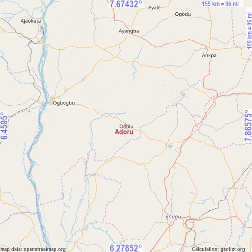
| Upper-left | 7.67432°, | 6.4595° |
| Center: | 6.97694°, | 7.16262° |
| Lower-right: | 6.27852°, | 7.86575° |
| Map W x H: | 155.2×155.2 km | = 96.4×96.4mi |
| max Lat: | 13.7543° ⇑68.6% North |
| Adoru: | 6.97694° |
| min Lat: | ⇓31.4% South 4.31231° |
| min Long | Adoru | max Long |
| 2.73333° | 7.16262° | 14.46552° |
| W 47%⇐ | ⇒53% E |
Elevation
Elevation of Adoru is 90 m = 295 ft, and this is 206.5 m = 677 ft below average elevation for this country.
| Max E: |
1599 m = 5246 ft | 78.6% |
| Avg. | 296.5 m = 973 ft | |
| Adoru | 90 m = 295 ft | |
Min E: |
2 m = 7 ft | 21.4% |
See also: Nigeria elevation on elevation.city.
Geographical zone
Adoru is located in North Torrid zone (between Equator and Tropic of Cancer). Distance of Equator is 775.8 km =482.1 mi to South.| Distance of | km | miles | from Adoru |
|---|---|---|---|
| North Pole | 9231.3 | 5736.1 | to North |
| Arctic Circle | 6625.4 | 4116.8 | to North |
| Tropic Cancer | 1830.2 | 1137.2 | to North |
| Equator | 775.8 | 482.1 | to South |


Nearby cities:
15 places around Adoru: (largest is in red/bold)
• Adani
31.2 km =19.4 mi,  212°
212°
• Ajaka
43.2 km =26.8 mi,  300°
300°
• Aku
34.4 km =21.4 mi,  150°
150°
• Enugu-Ezike
32.3 km =20.1 mi,  88°
88°
• Ete
34.4 km =21.4 mi,  68°
68°
• Ibagwa-Aka
26.9 km =16.7 mi,  103°
103°
• Idah
49.2 km =30.6 mi,  287°
287°
• Nsukka
28.9 km =18 mi,  117°
117°
• Obollo-Afor
39.9 km =24.8 mi, 99°
• Ogbede
41.1 km =25.5 mi, 145°
• Ogurugu
31.6 km =19.6 mi,  227°
227°
• Okpo
51.3 km =31.9 mi,  58°
58°
• Opi
36.9 km =22.9 mi,  125°
125°
• Ugwolawo
39.2 km =24.4 mi,  317°
317°
• Umulona
52.6 km =32.7 mi,  187°
187°
Sources, notices
• [Note1] Compared only with cities in Nigeria existing in our database
• [Src1] Map data: © OpenStreetMap contributors (CC-BY-SA)
• [Src2] Other city data from geonames.org with taken over terms of usage.
• [Src3] Geographical zone / Annual Mean Temperature by Robert A. Rohde @ Wikipedia
