Oudewater geodata
Oudewater (Utrecht) is a populated place; located in Netherlands in Europe/Amsterdam (GMT+2) time zone. With population of 9,836 people, there are 293 cities with bigger population in this country. Compared to other cities in Netherlands, 50.4% of cities are located further ↓South; 77.2% of cities are located further →East and 83.9% of cities have higher elevation than Oudewater. Note1


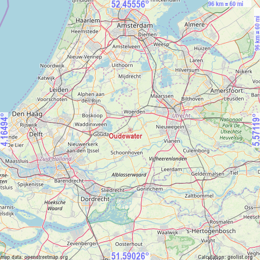
Oudewater GPS coordinates[2]
52° 1' 30" North, 4° 52' 5.016" East
| Map corner | latitude | longitude |
|---|---|---|
| Upper-left | 52.45556°, | 4.16494° |
| Center: | 52.025°, | 4.86806° |
| Lower-right: | 51.59026°, | 5.57119° |
| Map W x H: | 96.2×96.2 km | = 59.8×59.8mi |
| max Lat: | 53.48025° ⇑49.6% North |
| Oudewater: | 52.025° |
| min Lat: | ⇓50.4% South 50.76917° |
| min Long | Oudewater | max Long |
| 3.38611° | 4.86806° | 7.16528° |
| W 22.8%⇐ | ⇒77.2% E |
Elevation
Elevation of Oudewater is 1 m = 3 ft, and this is 14 m = 46 ft below average elevation for this country.
| Max E: |
203 m = 666 ft | 83.9% |
| Avg. | 15 m = 49 ft | |
| Oudewater | 1 m = 3 ft | |
Min E: |
-6 m = -20 ft | 16.1% |
See also: Netherlands elevation on elevation.city.
Geographical zone
Oudewater is located in North temperate zone (between Tropic of Cancer and the Arctic Circle). Distance of this North polar circle is 1616.5 km =1004.4 mi to North.| Distance of | km | miles | from Oudewater |
|---|---|---|---|
| North Pole | 4222.4 | 2623.7 | to North |
| Arctic Circle | 1616.5 | 1004.4 | to North |
| Tropic Cancer | 3178.7 | 1975.2 | to South |
| Equator | 5784.6 | 3594.4 | to South |


Nearby cities:
15 places around Oudewater: (largest is in red/bold)
• Cabauw
7.1 km =4.4 mi,  162°
162°
• Driebruggen
5.1 km =3.2 mi,  294°
294°
• Haastrecht
6.8 km =4.2 mi,  246°
246°
• Heeswijk
7.5 km =4.7 mi,  66°
66°
• Linschoten
5.3 km =3.3 mi,  37°
37°
• Lopik
8 km =5 mi,  136°
136°
• Montfoort
6.2 km =3.9 mi, 68°
• Schoonhoven
8.7 km =5.4 mi,  188°
188°
• Snelrewaard
2.8 km =1.7 mi,  84°
84°
• Stein
6.4 km =4 mi, 247°
• Stolwijk
8.7 km =5.4 mi,  227°
227°
• Vlist
6 km =3.7 mi,  213°
213°
• Waarder
5.1 km =3.2 mi,  320°
320°
• Weijpoort
7.7 km =4.8 mi, 324°
• Woerden
6.8 km =4.2 mi,  8°
8°
Sources, notices
• [Note1] Compared only with cities in Netherlands existing in our database
• [Src1] Map data: © OpenStreetMap contributors (CC-BY-SA)
• [Src2] Other city data from geonames.org with taken over terms of usage.
• [Src3] Geographical zone / Annual Mean Temperature by Robert A. Rohde @ Wikipedia
