Weerselo geodata
Weerselo (Overijssel) is a populated place; located in Netherlands in Europe/Amsterdam (GMT+2) time zone. With population of 700 people, there are 1626 cities with bigger population in this country. Compared to other cities in Netherlands, 68% of cities are located further ↓South; 96% of cities are located further ←West and 74.9% of cities have lower elevation than Weerselo. Note1


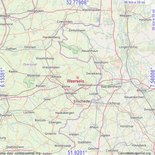
Weerselo GPS coordinates[2]
52° 21' 6.012" North, 6° 51' 24.984" East
| Map corner | latitude | longitude |
|---|---|---|
| Upper-left | 52.77906°, | 6.15381° |
| Center: | 52.35167°, | 6.85694° |
| Lower-right: | 51.9201°, | 7.56006° |
| Map W x H: | 95.5×95.5 km | = 59.3×59.3mi |
| max Lat: | 53.48025° ⇑32% North |
| Weerselo: | 52.35167° |
| min Lat: | ⇓68% South 50.76917° |
| min Long | Weerselo | max Long |
| 3.38611° | 6.85694° | 7.16528° |
| W 96%⇐ | ⇒4% E |
Elevation
Elevation of Weerselo is 18 m = 59 ft, and this is 3 m = 10 ft above average elevation for this country.
| Max E: |
203 m = 666 ft | 25.1% |
| Weerselo | 18 m 59 ft | |
| Avg. | 15 m = 49 ft | |
Min E: |
-6 m = -20 ft | 74.9% |
See also: Netherlands elevation on elevation.city.
Geographical zone
Weerselo is located in North temperate zone (between Tropic of Cancer and the Arctic Circle). Distance of this North polar circle is 1580.2 km =981.9 mi to North.| Distance of | km | miles | from Weerselo |
|---|---|---|---|
| North Pole | 4186.1 | 2601.1 | to North |
| Arctic Circle | 1580.2 | 981.9 | to North |
| Tropic Cancer | 3215 | 1997.7 | to South |
| Equator | 5821 | 3617 | to South |


Nearby cities:
15 places around Weerselo: (largest is in red/bold)
• Almelo
13.2 km =8.2 mi,  272°
272°
• Borne
9.3 km =5.8 mi,  232°
232°
• Hengelo
10.5 km =6.5 mi,  204°
204°
• Klein Driene
9.6 km =6 mi, 196°
• Mekkelholt
13 km =8.1 mi,  169°
169°
• Nijrees
13.2 km =8.2 mi,  261°
261°
• Oldenzaal
6.5 km =4 mi,  130°
130°
• Ootmarsum
7 km =4.3 mi,  25°
25°
• Rossum
4.4 km =2.7 mi,  90°
90°
• Saasveld
4.1 km =2.5 mi,  236°
236°
• Tilligte
8.8 km =5.5 mi,  46°
46°
• Tubbergen
7.9 km =4.9 mi,  321°
321°
• Woolde
11.1 km =6.9 mi,  216°
216°
• Zenderen
9.6 km =6 mi,  251°
251°
• Zuid-Berghuizen
7.7 km =4.8 mi,  137°
137°
Sources, notices
• [Note1] Compared only with cities in Netherlands existing in our database
• [Src1] Map data: © OpenStreetMap contributors (CC-BY-SA)
• [Src2] Other city data from geonames.org with taken over terms of usage.
• [Src3] Geographical zone / Annual Mean Temperature by Robert A. Rohde @ Wikipedia
