Staphorst geodata
Staphorst (Overijssel) is a populated place; located in Netherlands in Europe/Amsterdam (GMT+2) time zone. With population of 15,765 people, there are 220 cities with bigger population in this country. Compared to other cities in Netherlands, 74.6% of cities are located further ↓South; 83.6% of cities are located further ←West and 91.3% of cities have higher elevation than Staphorst. Note1


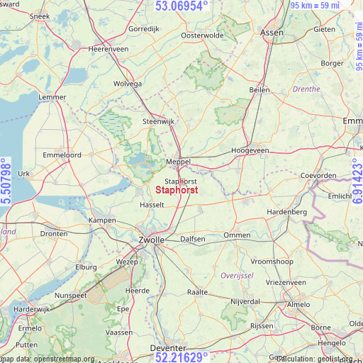
Staphorst GPS coordinates[2]
52° 38' 42" North, 6° 12' 39.996" East
| Map corner | latitude | longitude |
|---|---|---|
| Upper-left | 53.06954°, | 5.50798° |
| Center: | 52.645°, | 6.21111° |
| Lower-right: | 52.21629°, | 6.91423° |
| Map W x H: | 94.9×94.9 km | = 59×59mi |
| max Lat: | 53.48025° ⇑25.4% North |
| Staphorst: | 52.645° |
| min Lat: | ⇓74.6% South 50.76917° |
| min Long | Staphorst | max Long |
| 3.38611° | 6.21111° | 7.16528° |
| W 83.6%⇐ | ⇒16.4% E |
Elevation
Elevation of Staphorst is 0 m = 0 ft, and this is 15 m = 49 ft below average elevation for this country.
| Max E: |
203 m = 666 ft | 91.3% |
| Avg. | 15 m = 49 ft | |
| Staphorst | 0 m = 0 ft | |
Min E: |
-6 m = -20 ft | 8.7% |
See also: Netherlands elevation on elevation.city.
Geographical zone
Staphorst is located in North temperate zone (between Tropic of Cancer and the Arctic Circle). Distance of this North polar circle is 1547.6 km =961.6 mi to North.| Distance of | km | miles | from Staphorst |
|---|---|---|---|
| North Pole | 4153.5 | 2580.9 | to North |
| Arctic Circle | 1547.6 | 961.6 | to North |
| Tropic Cancer | 3247.7 | 2018 | to South |
| Equator | 5853.6 | 3637.3 | to South |


Nearby cities:
15 places around Staphorst: (largest is in red/bold)
• Belt-Schutsloot
10.4 km =6.5 mi,  286°
286°
• Berkum
14.4 km =8.9 mi,  200°
200°
• Brinkhoek
13.5 km =8.4 mi,  206°
206°
• Dalfsen
15.1 km =9.4 mi,  168°
168°
• Darp
14.5 km =9 mi,  358°
358°
• De Wijk
6.2 km =3.9 mi,  59°
59°
• Giethoorn
13.8 km =8.6 mi,  319°
319°
• Hasselt
9.7 km =6 mi,  233°
233°
• Havelte
14 km =8.7 mi,  8°
8°
• IJhorst
5.7 km =3.5 mi,  73°
73°
• Koekange
9.3 km =5.8 mi,  49°
49°
• Meppel
5.8 km =3.6 mi,  348°
348°
• Ruinen
16.2 km =10.1 mi,  36°
36°
• Ruinerwold
9.1 km =5.7 mi,  16°
16°
• Sint Jansklooster
14.3 km =8.9 mi,  284°
284°
Sources, notices
• [Note1] Compared only with cities in Netherlands existing in our database
• [Src1] Map data: © OpenStreetMap contributors (CC-BY-SA)
• [Src2] Other city data from geonames.org with taken over terms of usage.
• [Src3] Geographical zone / Annual Mean Temperature by Robert A. Rohde @ Wikipedia
