Belt-Schutsloot geodata
Belt-Schutsloot (Overijssel) is a populated place; located in Netherlands in Europe/Amsterdam (GMT+2) time zone. With population of 560 people, there are 1767 cities with bigger population in this country. Compared to other cities in Netherlands, 75.4% of cities are located further ↓South; 77.1% of cities are located further ←West and 83.9% of cities have higher elevation than Belt-Schutsloot. Note1


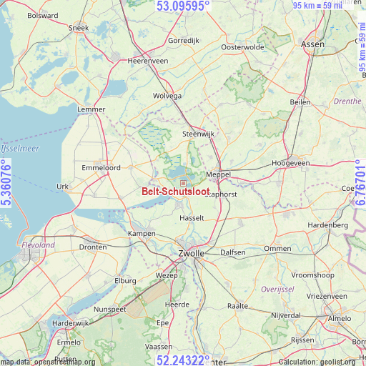
Belt-Schutsloot GPS coordinates[2]
52° 40' 18.012" North, 6° 3' 50.004" East
| Map corner | latitude | longitude |
|---|---|---|
| Upper-left | 53.09595°, | 5.36076° |
| Center: | 52.67167°, | 6.06389° |
| Lower-right: | 52.24322°, | 6.76701° |
| Map W x H: | 94.8×94.8 km | = 58.9×58.9mi |
| max Lat: | 53.48025° ⇑24.6% North |
| Belt-Schutsloot: | 52.67167° |
| min Lat: | ⇓75.4% South 50.76917° |
| min Long | Belt-Schutsloot | max Long |
| 3.38611° | 6.06389° | 7.16528° |
| W 77.1%⇐ | ⇒22.9% E |
Elevation
Elevation of Belt-Schutsloot is 1 m = 3 ft, and this is 14 m = 46 ft below average elevation for this country.
| Max E: |
203 m = 666 ft | 83.9% |
| Avg. | 15 m = 49 ft | |
| Belt-Schutsloot | 1 m = 3 ft | |
Min E: |
-6 m = -20 ft | 16.1% |
See also: Netherlands elevation on elevation.city.
Geographical zone
Belt-Schutsloot is located in North temperate zone (between Tropic of Cancer and the Arctic Circle). Distance of this North polar circle is 1544.6 km =959.8 mi to North.| Distance of | km | miles | from Belt-Schutsloot |
|---|---|---|---|
| North Pole | 4150.5 | 2579 | to North |
| Arctic Circle | 1544.6 | 959.8 | to North |
| Tropic Cancer | 3250.6 | 2019.8 | to South |
| Equator | 5856.5 | 3639.1 | to South |


Nearby cities:
15 places around Belt-Schutsloot: (largest is in red/bold)
• Blokzijl
9.2 km =5.7 mi,  311°
311°
• Giethoorn
7.7 km =4.8 mi,  7°
7°
• Grafhorst
13.3 km =8.3 mi,  221°
221°
• Hasselt
9 km =5.6 mi,  166°
166°
• Meppel
9.2 km =5.7 mi,  73°
73°
• Oosterholt
14.5 km =9 mi,  210°
210°
• Oostermeenthe
14.3 km =8.9 mi,  18°
18°
• Ruinerwold
13.7 km =8.5 mi, 65°
• Sint Jansklooster
4 km =2.5 mi,  279°
279°
• Staphorst
10.4 km =6.5 mi,  106°
106°
• Steenwijk
13.4 km =8.3 mi, 16°
• Steenwijkerwold
14.7 km =9.1 mi,  0°
0°
• Tuk
14.1 km =8.8 mi, 8°
• Vollenhove
7.5 km =4.7 mi, 277°
• Zuidveen
12.1 km =7.5 mi, 13°
Sources, notices
• [Note1] Compared only with cities in Netherlands existing in our database
• [Src1] Map data: © OpenStreetMap contributors (CC-BY-SA)
• [Src2] Other city data from geonames.org with taken over terms of usage.
• [Src3] Geographical zone / Annual Mean Temperature by Robert A. Rohde @ Wikipedia
