Giethoorn geodata
Giethoorn (Overijssel) is a populated place; located in Netherlands in Europe/Amsterdam (GMT+2) time zone. With population of 2,130 people, there are 927 cities with bigger population in this country. Compared to other cities in Netherlands, 77.9% of cities are located further ↓South; 78.3% of cities are located further ←West and 91.3% of cities have higher elevation than Giethoorn. Note1


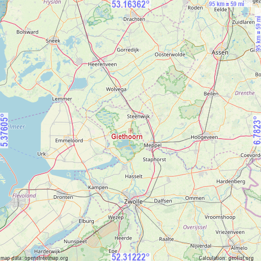
Giethoorn GPS coordinates[2]
52° 44' 24" North, 6° 4' 45.012" East
| Map corner | latitude | longitude |
|---|---|---|
| Upper-left | 53.16362°, | 5.37605° |
| Center: | 52.74°, | 6.07917° |
| Lower-right: | 52.31222°, | 6.7823° |
| Map W x H: | 94.7×94.7 km | = 58.8×58.8mi |
| max Lat: | 53.48025° ⇑22.1% North |
| Giethoorn: | 52.74° |
| min Lat: | ⇓77.9% South 50.76917° |
| min Long | Giethoorn | max Long |
| 3.38611° | 6.07917° | 7.16528° |
| W 78.3%⇐ | ⇒21.7% E |
Elevation
Elevation of Giethoorn is 0 m = 0 ft, and this is 15 m = 49 ft below average elevation for this country.
| Max E: |
203 m = 666 ft | 91.3% |
| Avg. | 15 m = 49 ft | |
| Giethoorn | 0 m = 0 ft | |
Min E: |
-6 m = -20 ft | 8.7% |
See also: Netherlands elevation on elevation.city.
Geographical zone
Giethoorn is located in North temperate zone (between Tropic of Cancer and the Arctic Circle). Distance of this North polar circle is 1537 km =955 mi to North.| Distance of | km | miles | from Giethoorn |
|---|---|---|---|
| North Pole | 4142.9 | 2574.3 | to North |
| Arctic Circle | 1537 | 955 | to North |
| Tropic Cancer | 3258.2 | 2024.6 | to South |
| Equator | 5864.1 | 3643.8 | to South |


Nearby cities:
15 places around Giethoorn: (largest is in red/bold)
• Belt-Schutsloot
7.7 km =4.8 mi,  187°
187°
• Blokzijl
8.1 km =5 mi,  259°
259°
• Darp
9.3 km =5.8 mi,  65°
65°
• Havelte
11.3 km =7 mi, 73°
• Meppel
9.2 km =5.7 mi,  122°
122°
• Oldemarkt
11.4 km =7.1 mi,  322°
322°
• Oostermeenthe
6.9 km =4.3 mi,  30°
30°
• Ruinerwold
11.6 km =7.2 mi,  99°
99°
• Sint Jansklooster
8.5 km =5.3 mi,  215°
215°
• Steenwijk
6 km =3.7 mi, 27°
• Steenwijkerwold
7.2 km =4.5 mi,  351°
351°
• Tuk
6.4 km =4 mi,  9°
9°
• Vollenhove
10.7 km =6.6 mi,  231°
231°
• Willemsoord
9.5 km =5.9 mi, 352°
• Zuidveen
4.6 km =2.9 mi,  24°
24°
Sources, notices
• [Note1] Compared only with cities in Netherlands existing in our database
• [Src1] Map data: © OpenStreetMap contributors (CC-BY-SA)
• [Src2] Other city data from geonames.org with taken over terms of usage.
• [Src3] Geographical zone / Annual Mean Temperature by Robert A. Rohde @ Wikipedia
