Slikkerveer geodata
Slikkerveer (South Holland) is a section of populated place; located in Netherlands in Europe/Amsterdam (GMT+2) time zone. With population of 8,750 people, there are 321 cities with bigger population in this country. Compared to other cities in Netherlands, 59% of cities are located further ↑North; 86.2% of cities are located further →East and 96.1% of cities have higher elevation than Slikkerveer. Note1


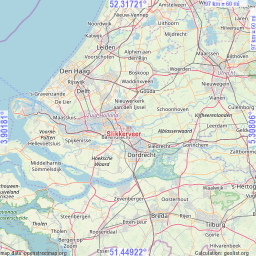
Slikkerveer GPS coordinates[2]
51° 53' 7.116" North, 4° 36' 17.784" East
| Map corner | latitude | longitude |
|---|---|---|
| Upper-left | 52.31721°, | 3.90181° |
| Center: | 51.88531°, | 4.60494° |
| Lower-right: | 51.44922°, | 5.30806° |
| Map W x H: | 96.5×96.5 km | = 60×60mi |
| max Lat: | 53.48025° ⇑59% North |
| Slikkerveer: | 51.88531° |
| min Lat: | ⇓41% South 50.76917° |
| min Long | Slikkerveer | max Long |
| 3.38611° | 4.60494° | 7.16528° |
| W 13.8%⇐ | ⇒86.2% E |
Elevation
Elevation of Slikkerveer is -1 m = -3 ft, and this is 16 m = 52 ft below average elevation for this country.
| Max E: |
203 m = 666 ft | 96.1% |
| Avg. | 15 m = 49 ft | |
| Slikkerveer | -1 m = -3 ft | |
Min E: |
-6 m = -20 ft | 3.9% |
See also: Netherlands elevation on elevation.city.
Geographical zone
Slikkerveer is located in North temperate zone (between Tropic of Cancer and the Arctic Circle). Distance of this North polar circle is 1632.1 km =1014.1 mi to North.| Distance of | km | miles | from Slikkerveer |
|---|---|---|---|
| North Pole | 4238 | 2633.4 | to North |
| Arctic Circle | 1632.1 | 1014.1 | to North |
| Tropic Cancer | 3163.2 | 1965.5 | to South |
| Equator | 5769.1 | 3584.8 | to South |


Nearby cities:
15 places around Slikkerveer: (largest is in red/bold)
• 's-Gravenland
5.5 km =3.4 mi,  319°
319°
• Alblasserdam
4.4 km =2.7 mi,  119°
119°
• Barendrecht
5.8 km =3.6 mi,  236°
236°
• Bolnes
2.1 km =1.3 mi,  301°
301°
• Capelle aan den IJssel
5.2 km =3.2 mi,  339°
339°
• Capelle-West
4.4 km =2.7 mi, 323°
• Groot IJsselmonde
3.8 km =2.4 mi,  265°
265°
• Hendrik-Ido-Ambacht
5.1 km =3.2 mi,  152°
152°
• Kinderdijk
1.9 km =1.2 mi,  88°
88°
• Krimpen aan den IJssel
3.5 km =2.2 mi,  357°
357°
• Lombardijen
5.8 km =3.6 mi,  257°
257°
• Nieuw-Lekkerland
5.6 km =3.5 mi, 85°
• Ouderkerk aan den IJssel
5.8 km =3.6 mi,  21°
21°
• Ridderkerk
1.4 km =0.9 mi,  185°
185°
• Rijsoord
3.9 km =2.4 mi, 189°
Sources, notices
• [Note1] Compared only with cities in Netherlands existing in our database
• [Src1] Map data: © OpenStreetMap contributors (CC-BY-SA)
• [Src2] Other city data from geonames.org with taken over terms of usage.
• [Src3] Geographical zone / Annual Mean Temperature by Robert A. Rohde @ Wikipedia
