Nieuw-Lekkerland geodata
Nieuw-Lekkerland (South Holland) is a populated place; located in Netherlands in Europe/Amsterdam (GMT+2) time zone. With population of 9,535 people, there are 298 cities with bigger population in this country. Compared to other cities in Netherlands, 58.6% of cities are located further ↑North; 83.5% of cities are located further →East and 91.3% of cities have higher elevation than Nieuw-Lekkerland. Note1


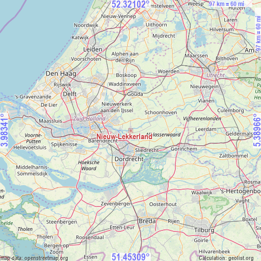
Nieuw-Lekkerland GPS coordinates[2]
51° 53' 20.94" North, 4° 41' 11.508" East
| Map corner | latitude | longitude |
|---|---|---|
| Upper-left | 52.32102°, | 3.98341° |
| Center: | 51.88915°, | 4.68653° |
| Lower-right: | 51.45309°, | 5.38966° |
| Map W x H: | 96.5×96.5 km | = 60×60mi |
| max Lat: | 53.48025° ⇑58.6% North |
| Nieuw-Lekkerland: | 51.88915° |
| min Lat: | ⇓41.4% South 50.76917° |
| min Long | Nieuw-Lekkerlan | max Long |
| 3.38611° | 4.68653° | 7.16528° |
| W 16.5%⇐ | ⇒83.5% E |
Elevation
Elevation of Nieuw-Lekkerland is 0 m = 0 ft, and this is 15 m = 49 ft below average elevation for this country.
| Max E: |
203 m = 666 ft | 91.3% |
| Avg. | 15 m = 49 ft | |
| Nieuw-Lekkerland | 0 m = 0 ft | |
Min E: |
-6 m = -20 ft | 8.7% |
See also: Netherlands elevation on elevation.city.
Geographical zone
Nieuw-Lekkerland is located in North temperate zone (between Tropic of Cancer and the Arctic Circle). Distance of this North polar circle is 1631.6 km =1013.8 mi to North.| Distance of | km | miles | from Nieuw-Lekkerland |
|---|---|---|---|
| North Pole | 4237.5 | 2633.1 | to North |
| Arctic Circle | 1631.6 | 1013.8 | to North |
| Tropic Cancer | 3163.6 | 1965.8 | to South |
| Equator | 5769.5 | 3585 | to South |


Nearby cities:
15 places around Nieuw-Lekkerland: (largest is in red/bold)
• Alblasserdam
3.1 km =1.9 mi,  213°
213°
• Bergstoep
7.7 km =4.8 mi,  61°
61°
• Berkenwoude
6.4 km =4 mi,  12°
12°
• Bleskensgraaf
6.9 km =4.3 mi,  105°
105°
• Bolnes
7.4 km =4.6 mi,  275°
275°
• Hendrik-Ido-Ambacht
6 km =3.7 mi, 213°
• Kinderdijk
3.8 km =2.4 mi,  264°
264°
• Krimpen aan den IJssel
6.5 km =4 mi,  298°
298°
• Opperduit
2.1 km =1.3 mi, 57°
• Ouderkerk aan den IJssel
6.1 km =3.8 mi,  325°
325°
• Papendrecht
6.4 km =4 mi,  179°
179°
• Ridderkerk
6 km =3.7 mi,  252°
252°
• Rijsoord
7.5 km =4.7 mi,  235°
235°
• Slikkerveer
5.6 km =3.5 mi,  265°
265°
• Wijngaarden
7.2 km =4.5 mi,  133°
133°
Sources, notices
• [Note1] Compared only with cities in Netherlands existing in our database
• [Src1] Map data: © OpenStreetMap contributors (CC-BY-SA)
• [Src2] Other city data from geonames.org with taken over terms of usage.
• [Src3] Geographical zone / Annual Mean Temperature by Robert A. Rohde @ Wikipedia
