Reusel geodata
Reusel (North Brabant) is a populated place; located in Netherlands in Europe/Amsterdam (GMT+2) time zone. With population of 7,055 people, there are 362 cities with bigger population in this country. Compared to other cities in Netherlands, 87.5% of cities are located further ↑North; 67.6% of cities are located further →East and 89.8% of cities have lower elevation than Reusel. Note1


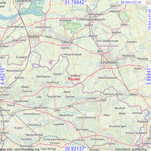
Reusel GPS coordinates[2]
51° 21' 45" North, 5° 9' 55.008" East
| Map corner | latitude | longitude |
|---|---|---|
| Upper-left | 51.79942°, | 4.46216° |
| Center: | 51.3625°, | 5.16528° |
| Lower-right: | 50.92137°, | 5.86841° |
| Map W x H: | 97.6×97.6 km | = 60.6×60.6mi |
| max Lat: | 53.48025° ⇑87.5% North |
| Reusel: | 51.3625° |
| min Lat: | ⇓12.5% South 50.76917° |
| min Long | Reusel | max Long |
| 3.38611° | 5.16528° | 7.16528° |
| W 32.4%⇐ | ⇒67.6% E |
Elevation
Elevation of Reusel is 33 m = 108 ft, and this is 18 m = 59 ft above average elevation for this country.
| Max E: |
203 m = 666 ft | 10.2% |
| Reusel | 33 m 108 ft | |
| Avg. | 15 m = 49 ft | |
Min E: |
-6 m = -20 ft | 89.8% |
See also: Netherlands elevation on elevation.city.
Geographical zone
Reusel is located in North temperate zone (between Tropic of Cancer and the Arctic Circle). Distance of this North polar circle is 1690.2 km =1050.2 mi to North.| Distance of | km | miles | from Reusel |
|---|---|---|---|
| North Pole | 4296.1 | 2669.5 | to North |
| Arctic Circle | 1690.2 | 1050.2 | to North |
| Tropic Cancer | 3105.1 | 1929.4 | to South |
| Equator | 5711 | 3548.6 | to South |


Nearby cities:
15 places around Reusel: (largest is in red/bold)
• Bladel
3.9 km =2.4 mi,  80°
80°
• Casteren
6.3 km =3.9 mi,  52°
52°
• Diessen
12.6 km =7.8 mi,  3°
3°
• Duizel
9.2 km =5.7 mi,  85°
85°
• Eersel
10.6 km =6.6 mi, 93°
• Esbeek
11.2 km =7 mi,  350°
350°
• Hapert
6.4 km =4 mi, 84°
• Hooge Mierde
3.7 km =2.3 mi,  317°
317°
• Hoogeloon
8.1 km =5 mi,  61°
61°
• Hulsel
3 km =1.9 mi,  16°
16°
• Lage Mierde
5 km =3.1 mi, 345°
• Middelbeers
13 km =8.1 mi,  26°
26°
• Netersel
5.4 km =3.4 mi, 33°
• Steensel
13.1 km =8.1 mi, 83°
• Weebosch
10.8 km =6.7 mi,  123°
123°
Sources, notices
• [Note1] Compared only with cities in Netherlands existing in our database
• [Src1] Map data: © OpenStreetMap contributors (CC-BY-SA)
• [Src2] Other city data from geonames.org with taken over terms of usage.
• [Src3] Geographical zone / Annual Mean Temperature by Robert A. Rohde @ Wikipedia
