Netersel geodata
Netersel (North Brabant) is a populated place; located in Netherlands in Europe/Amsterdam (GMT+2) time zone. With population of 765 people, there are 1558 cities with bigger population in this country. Compared to other cities in Netherlands, 86.2% of cities are located further ↑North; 66.2% of cities are located further →East and 86.2% of cities have lower elevation than Netersel. Note1


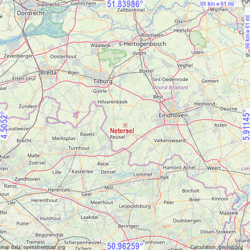
Netersel GPS coordinates[2]
51° 24' 11.988" North, 5° 12' 29.988" East
| Map corner | latitude | longitude |
|---|---|---|
| Upper-left | 51.83986°, | 4.5052° |
| Center: | 51.40333°, | 5.20833° |
| Lower-right: | 50.96259°, | 5.91145° |
| Map W x H: | 97.5×97.5 km | = 60.6×60.6mi |
| max Lat: | 53.48025° ⇑86.2% North |
| Netersel: | 51.40333° |
| min Lat: | ⇓13.8% South 50.76917° |
| min Long | Netersel | max Long |
| 3.38611° | 5.20833° | 7.16528° |
| W 33.8%⇐ | ⇒66.2% E |
Elevation
Elevation of Netersel is 28 m = 92 ft, and this is 13 m = 43 ft above average elevation for this country.
| Max E: |
203 m = 666 ft | 13.8% |
| Netersel | 28 m 92 ft | |
| Avg. | 15 m = 49 ft | |
Min E: |
-6 m = -20 ft | 86.2% |
See also: Netherlands elevation on elevation.city.
Geographical zone
Netersel is located in North temperate zone (between Tropic of Cancer and the Arctic Circle). Distance of this North polar circle is 1685.7 km =1047.4 mi to North.| Distance of | km | miles | from Netersel |
|---|---|---|---|
| North Pole | 4291.5 | 2666.6 | to North |
| Arctic Circle | 1685.7 | 1047.4 | to North |
| Tropic Cancer | 3109.6 | 1932.2 | to South |
| Equator | 5715.5 | 3551.4 | to South |


Nearby cities:
15 places around Netersel: (largest is in red/bold)
• Bladel
4 km =2.5 mi,  167°
167°
• Casteren
2.2 km =1.4 mi,  110°
110°
• Diessen
8.4 km =5.2 mi,  344°
344°
• Duizel
7.3 km =4.5 mi,  122°
122°
• Eersel
9.2 km =5.7 mi, 123°
• Esbeek
8.1 km =5 mi,  322°
322°
• Hapert
5.1 km =3.2 mi,  139°
139°
• Hilvarenbeek
10.4 km =6.5 mi,  331°
331°
• Hooge Mierde
5.8 km =3.6 mi,  252°
252°
• Hoogeloon
4.2 km =2.6 mi,  98°
98°
• Hulsel
2.7 km =1.7 mi,  231°
231°
• Lage Mierde
4.2 km =2.6 mi,  273°
273°
• Middelbeers
7.6 km =4.7 mi,  22°
22°
• Oostelbeers
8.7 km =5.4 mi,  28°
28°
• Reusel
5.4 km =3.4 mi,  213°
213°
Sources, notices
• [Note1] Compared only with cities in Netherlands existing in our database
• [Src1] Map data: © OpenStreetMap contributors (CC-BY-SA)
• [Src2] Other city data from geonames.org with taken over terms of usage.
• [Src3] Geographical zone / Annual Mean Temperature by Robert A. Rohde @ Wikipedia
