Ransdaal geodata
Ransdaal (Limburg) is a populated place; located in Netherlands in Europe/Amsterdam (GMT+2) time zone. With population of 910 people, there are 1455 cities with bigger population in this country. Compared to other cities in Netherlands, 97.7% of cities are located further ↑North; 63.7% of cities are located further ←West and 97.5% of cities have lower elevation than Ransdaal. Note1


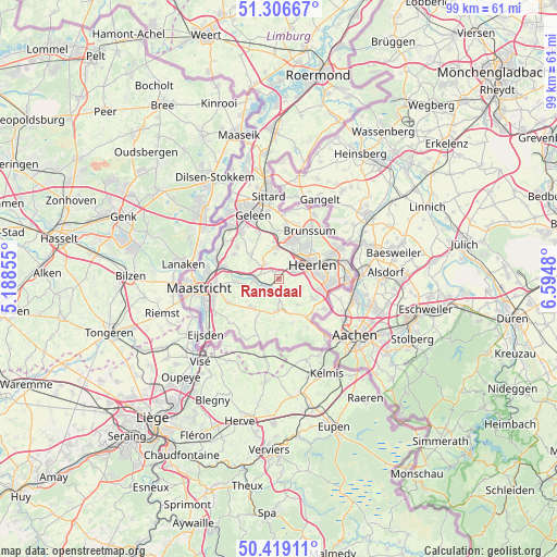
Ransdaal GPS coordinates[2]
50° 51' 54" North, 5° 53' 30.012" East
| Map corner | latitude | longitude |
|---|---|---|
| Upper-left | 51.30667°, | 5.18855° |
| Center: | 50.865°, | 5.89167° |
| Lower-right: | 50.41911°, | 6.5948° |
| Map W x H: | 98.7×98.7 km | = 61.3×61.3mi |
| max Lat: | 53.48025° ⇑97.7% North |
| Ransdaal: | 50.865° |
| min Lat: | ⇓2.3% South 50.76917° |
| min Long | Ransdaal | max Long |
| 3.38611° | 5.89167° | 7.16528° |
| W 63.7%⇐ | ⇒36.3% E |
Elevation
Elevation of Ransdaal is 108 m = 354 ft, and this is 93 m = 305 ft above average elevation for this country.
| Max E: |
203 m = 666 ft | 2.5% |
| Ransdaal | 108 m 354 ft | |
| Avg. | 15 m = 49 ft | |
Min E: |
-6 m = -20 ft | 97.5% |
See also: Netherlands elevation on elevation.city.
Geographical zone
Ransdaal is located in North temperate zone (between Tropic of Cancer and the Arctic Circle). Distance of this North polar circle is 1745.5 km =1084.6 mi to North.| Distance of | km | miles | from Ransdaal |
|---|---|---|---|
| North Pole | 4351.4 | 2703.8 | to North |
| Arctic Circle | 1745.5 | 1084.6 | to North |
| Tropic Cancer | 3049.7 | 1895 | to South |
| Equator | 5655.7 | 3514.3 | to South |


Nearby cities:
15 places around Ransdaal: (largest is in red/bold)
• Arensgenhout
4.4 km =2.7 mi,  305°
305°
• Broekhem
5 km =3.1 mi,  277°
277°
• Gulpen
5.5 km =3.4 mi,  182°
182°
• Hulsberg
3.7 km =2.3 mi,  316°
316°
• Husken
5.7 km =3.5 mi,  53°
53°
• Klimmen
1.4 km =0.9 mi,  327°
327°
• Kunrade
3.1 km =1.9 mi,  62°
62°
• Schin op Geul
2 km =1.2 mi,  232°
232°
• Sibbe
5.1 km =3.2 mi,  243°
243°
• Termaar
0.4 km =0.2 mi, 332°
• Ubachsberg
4.2 km =2.6 mi,  107°
107°
• Valkenburg
4.2 km =2.6 mi,  270°
270°
• Voerendaal
3.4 km =2.1 mi, 52°
• Wijlre
3.5 km =2.2 mi, 175°
• Wijnandsrade
4.6 km =2.9 mi,  352°
352°
Sources, notices
• [Note1] Compared only with cities in Netherlands existing in our database
• [Src1] Map data: © OpenStreetMap contributors (CC-BY-SA)
• [Src2] Other city data from geonames.org with taken over terms of usage.
• [Src3] Geographical zone / Annual Mean Temperature by Robert A. Rohde @ Wikipedia
