Ubachsberg geodata
Ubachsberg (Limburg) is a populated place; located in Netherlands in Europe/Amsterdam (GMT+2) time zone. With population of 1,420 people, there are 1170 cities with bigger population in this country. Compared to other cities in Netherlands, 98.2% of cities are located further ↑North; 67.7% of cities are located further ←West and 99.9% of cities have lower elevation than Ubachsberg. Note1


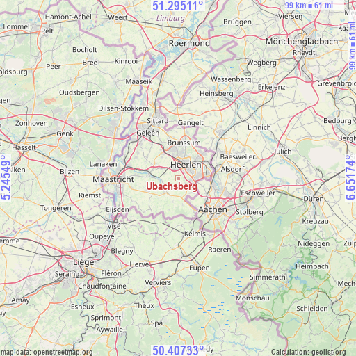
Ubachsberg GPS coordinates[2]
50° 51' 11.988" North, 5° 56' 54.996" East
| Map corner | latitude | longitude |
|---|---|---|
| Upper-left | 51.29511°, | 5.24549° |
| Center: | 50.85333°, | 5.94861° |
| Lower-right: | 50.40733°, | 6.65174° |
| Map W x H: | 98.7×98.7 km | = 61.3×61.3mi |
| max Lat: | 53.48025° ⇑98.2% North |
| Ubachsberg: | 50.85333° |
| min Lat: | ⇓1.8% South 50.76917° |
| min Long | Ubachsberg | max Long |
| 3.38611° | 5.94861° | 7.16528° |
| W 67.7%⇐ | ⇒32.3% E |
Elevation
Elevation of Ubachsberg is 186 m = 610 ft, and this is 171 m = 561 ft above average elevation for this country.
| Max E: |
203 m = 666 ft | 0.099999999999994% |
| Ubachsberg | 186 m 610 ft | |
| Avg. | 15 m = 49 ft | |
Min E: |
-6 m = -20 ft | 99.9% |
See also: Netherlands elevation on elevation.city.
Geographical zone
Ubachsberg is located in North temperate zone (between Tropic of Cancer and the Arctic Circle). Distance of this North polar circle is 1746.8 km =1085.4 mi to North.| Distance of | km | miles | from Ubachsberg |
|---|---|---|---|
| North Pole | 4352.7 | 2704.6 | to North |
| Arctic Circle | 1746.8 | 1085.4 | to North |
| Tropic Cancer | 3048.4 | 1894.2 | to South |
| Equator | 5654.4 | 3513.5 | to South |


Nearby cities:
15 places around Ubachsberg: (largest is in red/bold)
• Bocholtz
5.6 km =3.5 mi,  134°
134°
• Bocholtzerheide
5.1 km =3.2 mi,  144°
144°
• Gracht
5.6 km =3.5 mi,  91°
91°
• Heerlen
4.1 km =2.5 mi,  34°
34°
• Husken
4.7 km =2.9 mi,  6°
6°
• Klimmen
5.4 km =3.4 mi,  297°
297°
• Kunrade
3 km =1.9 mi,  335°
335°
• Nijswiller
4.9 km =3 mi,  173°
173°
• Ransdaal
4.2 km =2.6 mi,  287°
287°
• Simpelveld
3.2 km =2 mi, 132°
• Spekholzerheide
5.3 km =3.3 mi, 87°
• Termaar
4.5 km =2.8 mi, 291°
• Terwinselen
5.5 km =3.4 mi,  74°
74°
• Voerendaal
3.6 km =2.2 mi, 338°
• Wijlre
4.3 km =2.7 mi,  239°
239°
Sources, notices
• [Note1] Compared only with cities in Netherlands existing in our database
• [Src1] Map data: © OpenStreetMap contributors (CC-BY-SA)
• [Src2] Other city data from geonames.org with taken over terms of usage.
• [Src3] Geographical zone / Annual Mean Temperature by Robert A. Rohde @ Wikipedia
