Nispen geodata
Nispen (North Brabant) is a populated place; located in Netherlands in Europe/Amsterdam (GMT+2) time zone. With population of 1,245 people, there are 1264 cities with bigger population in this country. Compared to other cities in Netherlands, 82.1% of cities are located further ↑North; 90.4% of cities are located further →East and 69% of cities have lower elevation than Nispen. Note1


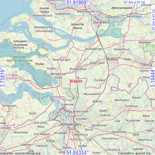
Nispen GPS coordinates[2]
51° 28' 59.916" North, 4° 27' 40.716" East
| Map corner | latitude | longitude |
|---|---|---|
| Upper-left | 51.91908°, | 3.75819° |
| Center: | 51.48331°, | 4.46131° |
| Lower-right: | 51.04334°, | 5.16444° |
| Map W x H: | 97.4×97.4 km | = 60.5×60.5mi |
| max Lat: | 53.48025° ⇑82.1% North |
| Nispen: | 51.48331° |
| min Lat: | ⇓17.9% South 50.76917° |
| min Long | Nispen | max Long |
| 3.38611° | 4.46131° | 7.16528° |
| W 9.6%⇐ | ⇒90.4% E |
Elevation
Elevation of Nispen is 14 m = 46 ft, and this is 1 m = 3 ft below average elevation for this country.
| Max E: |
203 m = 666 ft | 31% |
| Avg. | 15 m = 49 ft | |
| Nispen | 14 m = 46 ft | |
Min E: |
-6 m = -20 ft | 69% |
See also: Netherlands elevation on elevation.city.
Geographical zone
Nispen is located in North temperate zone (between Tropic of Cancer and the Arctic Circle). Distance of this North polar circle is 1676.8 km =1041.9 mi to North.| Distance of | km | miles | from Nispen |
|---|---|---|---|
| North Pole | 4282.7 | 2661.1 | to North |
| Arctic Circle | 1676.8 | 1041.9 | to North |
| Tropic Cancer | 3118.5 | 1937.7 | to South |
| Equator | 5724.4 | 3557 | to South |


Nearby cities:
15 places around Nispen: (largest is in red/bold)
• Achtmaal
9.1 km =5.7 mi,  110°
110°
• Bosschenhoofd
10.2 km =6.3 mi,  32°
32°
• Heerle
8.1 km =5 mi,  299°
299°
• Huijbergen
8.2 km =5.1 mi,  226°
226°
• Hulsdonk
4.8 km =3 mi,  344°
344°
• Kalsdonk
6.3 km =3.9 mi,  6°
6°
• Kruisland
10.2 km =6.3 mi, 339°
• Roosendaal
5.3 km =3.3 mi,  2°
2°
• Rucphen
8.6 km =5.3 mi,  51°
51°
• Schijf
7.1 km =4.4 mi,  75°
75°
• Sint Willebrord
11.4 km =7.1 mi, 50°
• Sprundel
11.2 km =7 mi,  57°
57°
• Wouw
6.5 km =4 mi,  310°
310°
• Wouwse Plantage
5.1 km =3.2 mi,  271°
271°
• Zegge
9.1 km =5.7 mi, 25°
Sources, notices
• [Note1] Compared only with cities in Netherlands existing in our database
• [Src1] Map data: © OpenStreetMap contributors (CC-BY-SA)
• [Src2] Other city data from geonames.org with taken over terms of usage.
• [Src3] Geographical zone / Annual Mean Temperature by Robert A. Rohde @ Wikipedia
