Hulsdonk geodata
Hulsdonk (North Brabant) is a section of populated place; located in Netherlands in Europe/Amsterdam (GMT+2) time zone. With population of 980 people, there are 1415 cities with bigger population in this country. Compared to other cities in Netherlands, 78.9% of cities are located further ↑North; 91% of cities are located further →East and 54.1% of cities have higher elevation than Hulsdonk. Note1


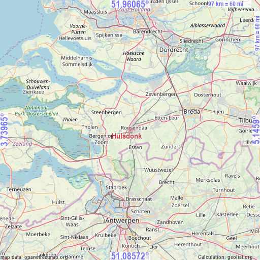
Hulsdonk GPS coordinates[2]
51° 31' 31.044" North, 4° 26' 33.972" East
| Map corner | latitude | longitude |
|---|---|---|
| Upper-left | 51.96065°, | 3.73965° |
| Center: | 51.52529°, | 4.44277° |
| Lower-right: | 51.08572°, | 5.1459° |
| Map W x H: | 97.3×97.3 km | = 60.5×60.5mi |
| max Lat: | 53.48025° ⇑78.9% North |
| Hulsdonk: | 51.52529° |
| min Lat: | ⇓21.1% South 50.76917° |
| min Long | Hulsdonk | max Long |
| 3.38611° | 4.44277° | 7.16528° |
| W 9%⇐ | ⇒91% E |
Elevation
Elevation of Hulsdonk is 5 m = 16 ft, and this is 10 m = 33 ft below average elevation for this country.
| Max E: |
203 m = 666 ft | 54.1% |
| Avg. | 15 m = 49 ft | |
| Hulsdonk | 5 m = 16 ft | |
Min E: |
-6 m = -20 ft | 45.9% |
See also: Netherlands elevation on elevation.city.
Geographical zone
Hulsdonk is located in North temperate zone (between Tropic of Cancer and the Arctic Circle). Distance of this North polar circle is 1672.1 km =1039 mi to North.| Distance of | km | miles | from Hulsdonk |
|---|---|---|---|
| North Pole | 4278 | 2658.2 | to North |
| Arctic Circle | 1672.1 | 1039 | to North |
| Tropic Cancer | 3123.2 | 1940.7 | to South |
| Equator | 5729.1 | 3559.9 | to South |


Nearby cities:
15 places around Hulsdonk: (largest is in red/bold)
• Bosschenhoofd
7.8 km =4.8 mi,  59°
59°
• Heerle
5.8 km =3.6 mi,  263°
263°
• Kalsdonk
2.5 km =1.6 mi,  50°
50°
• Kruisland
5.4 km =3.4 mi,  334°
334°
• Nispen
4.8 km =3 mi,  164°
164°
• Oud Gastel
6.9 km =4.3 mi,  9°
9°
• Roosendaal
1.7 km =1.1 mi,  68°
68°
• Rucphen
8 km =5 mi,  84°
84°
• Schijf
8.7 km =5.4 mi,  109°
109°
• Stampersgat
9.8 km =6.1 mi,  0°
0°
• Stoof
8.6 km =5.3 mi,  16°
16°
• Welberg
9.6 km =6 mi,  306°
306°
• Wouw
3.7 km =2.3 mi, 263°
• Wouwse Plantage
6 km =3.7 mi,  219°
219°
• Zegge
6.3 km =3.9 mi, 56°
Sources, notices
• [Note1] Compared only with cities in Netherlands existing in our database
• [Src1] Map data: © OpenStreetMap contributors (CC-BY-SA)
• [Src2] Other city data from geonames.org with taken over terms of usage.
• [Src3] Geographical zone / Annual Mean Temperature by Robert A. Rohde @ Wikipedia
