Lopikerkapel geodata
Lopikerkapel (Utrecht) is a populated place; located in Netherlands in Europe/Amsterdam (GMT+2) time zone. With population of 530 people, there are 1796 cities with bigger population in this country. Compared to other cities in Netherlands, 51.8% of cities are located further ↑North; 72.2% of cities are located further →East and 74.9% of cities have higher elevation than Lopikerkapel. Note1


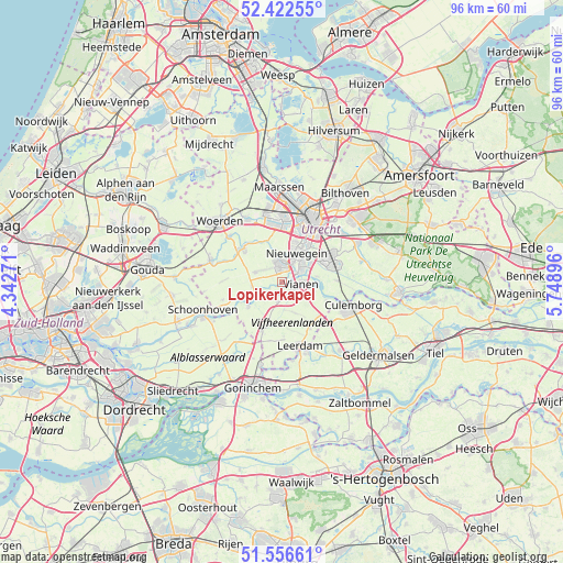
Lopikerkapel GPS coordinates[2]
51° 59' 30.012" North, 5° 2' 44.988" East
| Map corner | latitude | longitude |
|---|---|---|
| Upper-left | 52.42255°, | 4.34271° |
| Center: | 51.99167°, | 5.04583° |
| Lower-right: | 51.55661°, | 5.74896° |
| Map W x H: | 96.3×96.3 km | = 59.8×59.8mi |
| max Lat: | 53.48025° ⇑51.8% North |
| Lopikerkapel: | 51.99167° |
| min Lat: | ⇓48.2% South 50.76917° |
| min Long | Lopikerkapel | max Long |
| 3.38611° | 5.04583° | 7.16528° |
| W 27.8%⇐ | ⇒72.2% E |
Elevation
Elevation of Lopikerkapel is 2 m = 7 ft, and this is 13 m = 43 ft below average elevation for this country.
| Max E: |
203 m = 666 ft | 74.9% |
| Avg. | 15 m = 49 ft | |
| Lopikerkapel | 2 m = 7 ft | |
Min E: |
-6 m = -20 ft | 25.1% |
See also: Netherlands elevation on elevation.city.
Geographical zone
Lopikerkapel is located in North temperate zone (between Tropic of Cancer and the Arctic Circle). Distance of this North polar circle is 1620.2 km =1006.7 mi to North.| Distance of | km | miles | from Lopikerkapel |
|---|---|---|---|
| North Pole | 4226.1 | 2626 | to North |
| Arctic Circle | 1620.2 | 1006.7 | to North |
| Tropic Cancer | 3175 | 1972.9 | to South |
| Equator | 5780.9 | 3592.1 | to South |


Nearby cities:
15 places around Lopikerkapel: (largest is in red/bold)
• De Hagen
3.9 km =2.4 mi,  86°
86°
• Everdingen
8.1 km =5 mi,  111°
111°
• Graaf
4.7 km =2.9 mi,  255°
255°
• Hagestein
5.4 km =3.4 mi,  102°
102°
• Heeswijk
8.5 km =5.3 mi,  321°
321°
• Houten
9.3 km =5.8 mi,  64°
64°
• IJsselstein
3.2 km =2 mi,  356°
356°
• Lopik
7 km =4.3 mi,  252°
252°
• Montfoort
8.8 km =5.5 mi,  313°
313°
• Nieuwegein
4.8 km =3 mi,  29°
29°
• Schoonrewoerd
9.3 km =5.8 mi,  148°
148°
• Uitweg
2.2 km =1.4 mi,  242°
242°
• Vianen
3.1 km =1.9 mi, 88°
• Vreeswijk
3.9 km =2.4 mi, 56°
• Zijderveld
8.5 km =5.3 mi,  130°
130°
Sources, notices
• [Note1] Compared only with cities in Netherlands existing in our database
• [Src1] Map data: © OpenStreetMap contributors (CC-BY-SA)
• [Src2] Other city data from geonames.org with taken over terms of usage.
• [Src3] Geographical zone / Annual Mean Temperature by Robert A. Rohde @ Wikipedia
